

 |
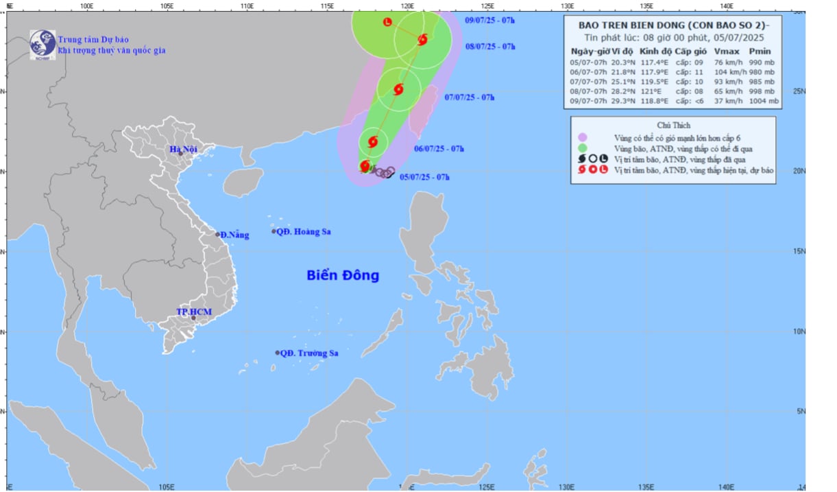
| Map of the trajectory and intensity of storm No. 2 released at 8:00 a.m. on July 5. |
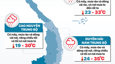
At 7:00 a.m., the center of the storm was at about 20.3 degrees North latitude and 117.4 degrees East longitude. The strongest wind near the center of the storm was level 8-9 (60-88 km/h), gusting to level 11, moving in a West Northwest direction at a speed of 5-10 km/h.
It is forecasted that in the next 72-96 hours, the storm will move northwest at a speed of about 10km/h and gradually weaken into a low pressure area.
The storm causes strong winds and large waves in the northeastern sea area. The northern East Sea area has stormy rain and winds of level 7-8. The sea area near the storm's center has winds of level 9-11, gusts of level 13, rough seas, waves 4-6m high. Ships operating in the above-mentioned dangerous areas are likely to be affected by storms, strong winds, and large waves.
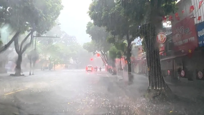
Weather in Dong Nai , clouds change to cloudy, afternoon and evening there are scattered showers and thunderstorms in many places, some places have moderate rain with heavy rain in thunderstorms, beware of tornadoes, lightning and strong gusts of wind.
Kim Lieu
Source: https://baodongnai.com.vn/tin-moi/202507/bao-so-2-di-chuyen-theo-huong-tay-bac-va-suy-yeu-dan-thanh-mot-vung-ap-thap-trong-72-96-gio-toi-2df01f1/
![[Photo] Brilliant red of the exhibition 95 years of the Party Flag lighting the way before the opening](https://vphoto.vietnam.vn/thumb/1200x675/vietnam/resource/IMAGE/2025/8/27/e19d957d17f649648ca14ce6cc4d8dd4)

![[Photo] Prime Minister Pham Minh Chinh receives CEO of Samsung Electronics](https://vphoto.vietnam.vn/thumb/1200x675/vietnam/resource/IMAGE/2025/8/26/373f5db99f704e6eb1321c787485c3c2)

![[Photo] Prime Minister Pham Minh Chinh chairs meeting of National Steering Committee on International Integration](https://vphoto.vietnam.vn/thumb/1200x675/vietnam/resource/IMAGE/2025/8/26/9d34a506f9fb42ac90a48179fc89abb3)


Comment (0)