
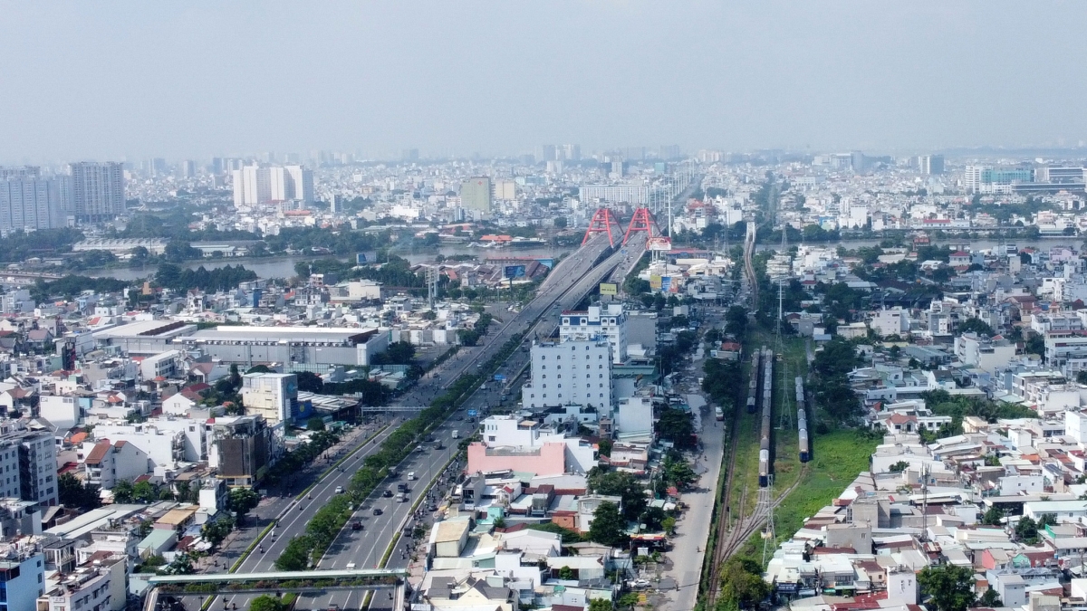
50 years after the Liberation of the South and the reunification of the country, Ho Chi Minh City has made constant efforts in developing transport and urban infrastructure. The city has made great strides, with a series of key projects and works contributing to changing the urban landscape and expanding the space for socio -economic development.
Many projects not only bring practical value but also become modern architectural symbols, contributing to shaping the urban identity of Ho Chi Minh City. VOV HCMC would like to review some typical projects and works that have been making a deep impression in the development process of the city.
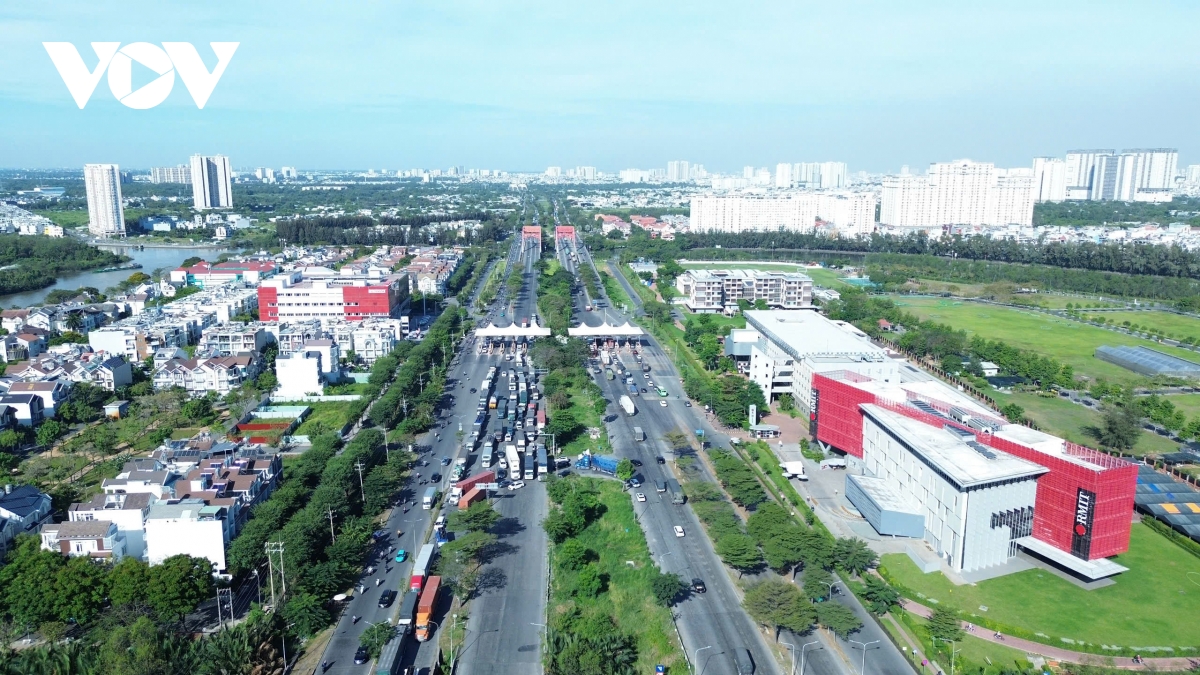
1. Nguyen Van Linh Avenue and Phu My Hung Urban Area: Swamp into urban area, symbol of urbanization process
Phu My Hung Urban Area (District 7) with Vo Van Kiet Avenue as its backbone is a symbol of the remarkable development of Ho Chi Minh City, when it transformed from a swampy area into a "model" urban area of Vietnam.
Originating from the fact that Phu My Hung Joint Stock Company (PMH) was granted an Investment License to build a new urban area in May 1993. By December 1994, the master plan was approved by the Prime Minister and in July 1996, the investor began to build Phu My Hung urban infrastructure.
Nguyen Van Linh Avenue and Phu My Hung Urban Area
On December 30, 1996, Nguyen Van Linh Boulevard Phase 1 was started with the participation of former Prime Minister Vo Van Kiet. In February 1998, Phase 1 was opened to traffic... The entire route was completed in December 2027.
The 17.8km long, 120m wide avenue has 10 lanes including 6 express lanes and 4 mixed lanes; the section passing through Area A – Phu My Hung Urban Center has 14 lanes. In the middle of the avenue is a 18 – 36m wide parkland reserved for the development of a future metro project.
Nguyen Van Linh Avenue and Phu My Hung Urban Area are the beginning of the implementation of the idea of industrialization and urbanization on low-productivity agricultural land in the former Nha Be District (now District 7 and Nha Be District) and Binh Chanh.
Nguyen Van Linh Avenue is not only the main traffic axis of the Southern area of Ho Chi Minh City, with great economic and social significance, but also a very important route connecting the Ho Chi Minh City - Trung Luong expressway to the Western provinces and Phu My bridge to District 2, Cat Lai, Nhon Trach, Long Thanh.
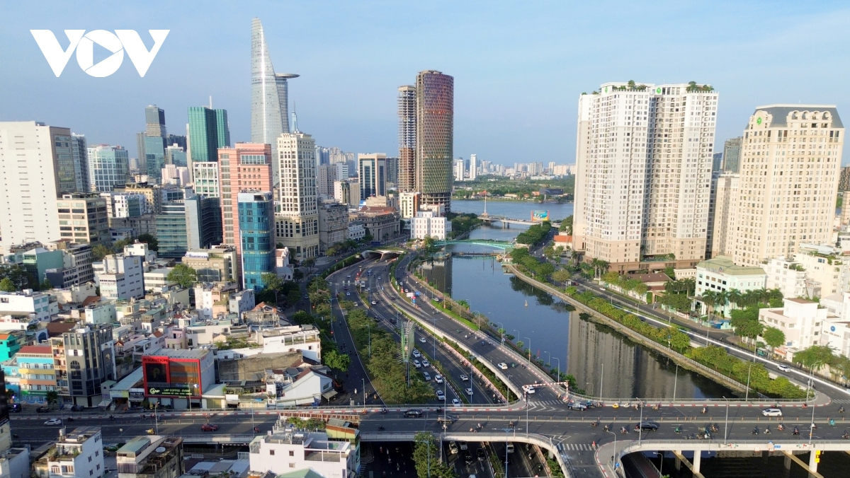
2. East-West Highway and Saigon River Tunnel: Strategic Highway with the most modern river tunnel in Southeast Asia
East-West Avenue or Vo Van Kiet - Mai Chi Tho Avenue, is a route passing through the center of Ho Chi Minh City. The 21.9km long avenue runs along the canal from National Highway 1 in Binh Chanh District, crosses the Saigon River through a tunnel, and extends to Cat Lai intersection (Thu Duc City); passing through districts 1, 5, 6, 8, Binh Tan, Binh Chanh District and Thu Duc City, forming an East-West traffic axis, and connecting the two ends of the Northeast - Southwest of the city.
East-West Avenue and Saigon River Tunnel
The East-West Highway facilitates traffic to and from Saigon Port and from here to the Eastern and Western provinces without having to go to the city center. This is a vital road that closely connects localities in the Southern key economic region.
The project has a total investment of 13,400 billion VND; construction started in January 2005 and was completed in 2011.
On the route, the Thu Thiem tunnel is nearly 1,500 m long, with an investment capital of more than 2,200 billion VND, connecting District 1 with Thu Thiem (Thu Duc City) is the most important item. The construction of an unprecedented project in Vietnam and the most modern in Southeast Asia encountered many difficulties, but all were overcome to complete the project, becoming a new symbol of the spirit of overcoming difficulties.
3. Metro Line 1 (Ben Thanh - Suoi Tien): Opening the era of modern urban transportation
Metro Line 1 (Ben Thanh - Suoi Tien) was first approved in 2007. In August 2012, construction of construction packages began and was expected to be completed in 2018. However, due to various reasons from capital sources, site clearance... it was not until December 2024 that the project officially went into commercial operation.
The Ben Thanh – Suoi Tien metro line has a total length of 19.7 km, of which 2.6 km is underground and 17.1 km is elevated through districts 1, 2, 9, Binh Thanh, Thu Duc City in Ho Chi Minh City and the last part of the line is in Di An town, Binh Duong province. The entire line has 14 stations, of which stations 1, 2, 3 are underground.
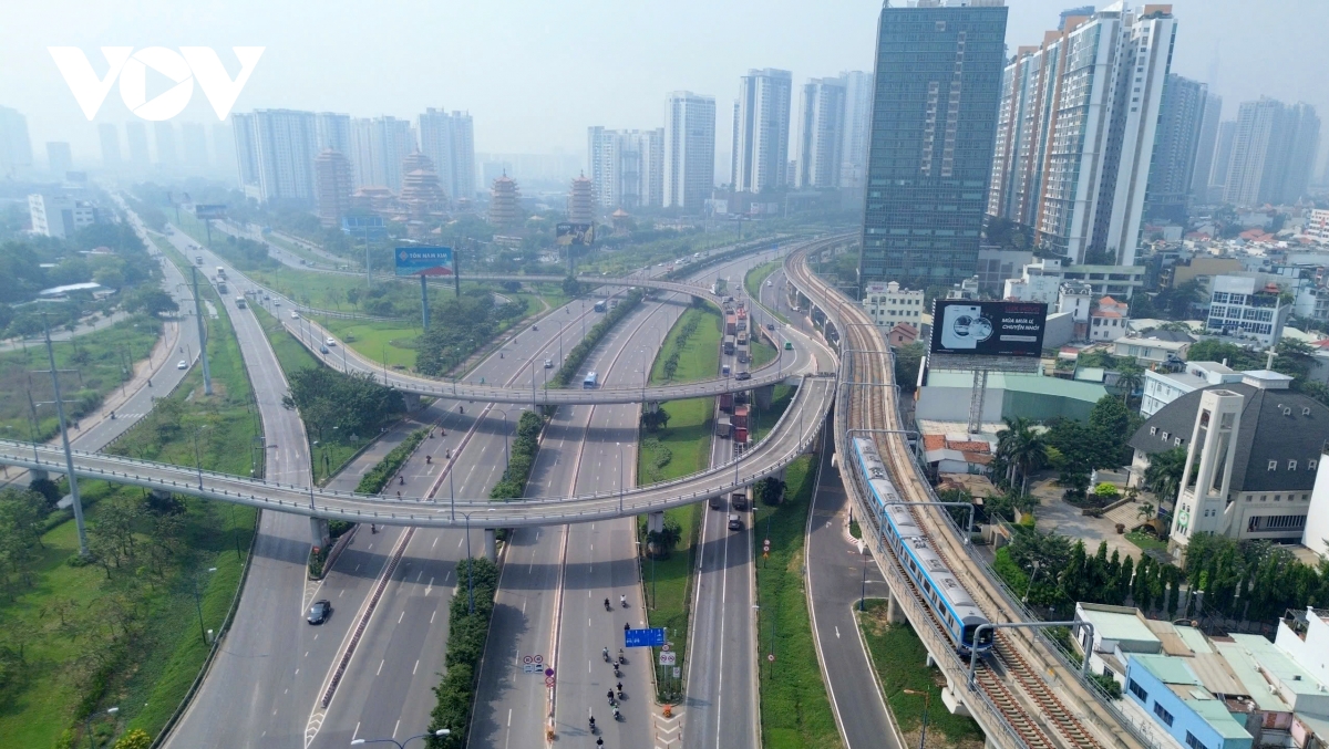
Metro Line 1 opens the era of modern urban transportation
Currently, Metro Line 1 operates from 5am to 10pm every day, carrying about 50,000 - 70,000 passengers per day.
From this initial line, Ho Chi Minh City is planning to build 355 km of metro from now until 2035. Ho Chi Minh City will develop metro lines with TOD orientation (urban development model oriented towards public transport development).
4. Phu My Bridge
Phu My Bridge is one of the largest cable-stayed bridges in Ho Chi Minh City, spanning the Saigon River, connecting District 7 and Thu Duc City. The bridge began construction in September 2005 and was completed on September 2, 2009, 4 months ahead of schedule. This is an important project to improve traffic between key areas of Ho Chi Minh City, reduce the load on existing roads, and connect Phu My Hung urban area with Thu Thiem new urban area.
Phu My Bridge
Phu My Bridge has a total length of more than 2km, including 6 lanes, and can serve up to 100,000 vehicles per day. Phu My Bridge is one of the key traffic projects of Ho Chi Minh City, not only connecting important areas of the city but also a symbol of development and modernization. With an advanced cable-stayed bridge design and the ability to serve large traffic volumes, Phu My Bridge has contributed to reducing traffic congestion, shortening travel time, and creating favorable conditions for the city's socio-economic development.
5. Nhieu Loc – Thi Nghe Canal Renovation Project: A winding green canal in the heart of the city
Nhieu Loc - Thi Nghe Canal is nearly 10 km long, flowing through Districts 1, 3, Binh Thanh, Phu Nhuan, Tan Binh, and emptying into the Saigon River.
Before the renovation, the canal was heavily polluted, with overgrown weeds and trash on both sides and dilapidated houses. The project started in 2003 with a total investment of VND8,600 billion.
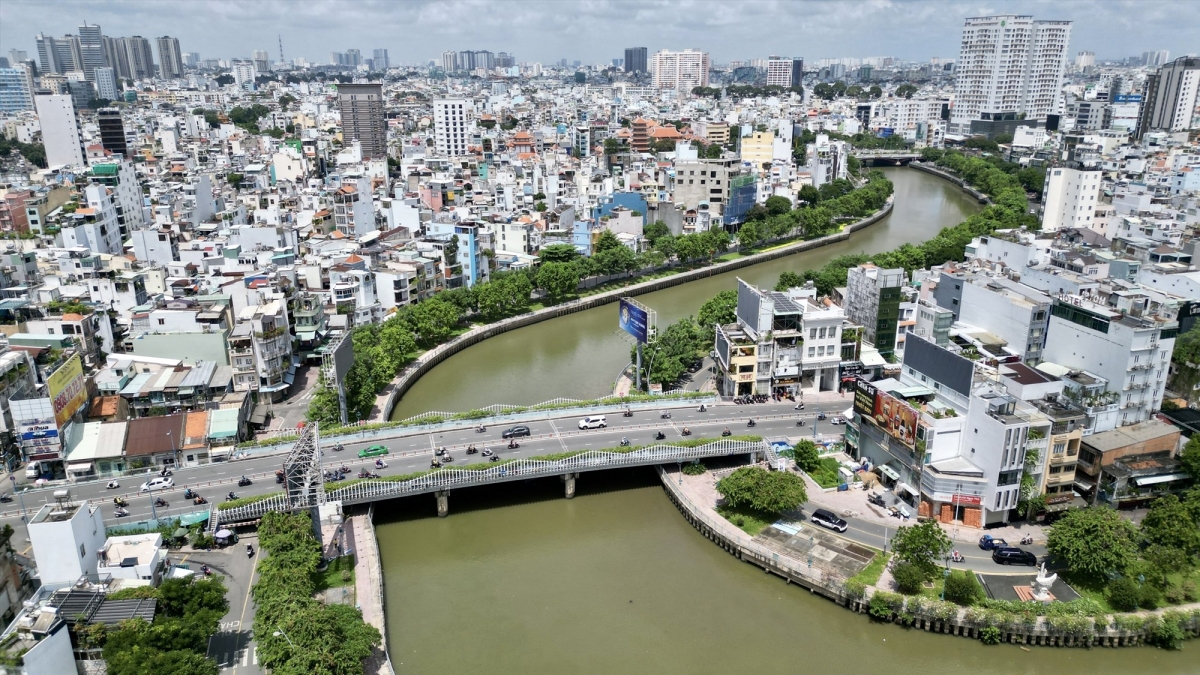
Nhieu Loc - Thi Nghe Canal
By August 2012, the project was completed with a clean and beautiful canal winding through the area; on both sides of the canal is the Hoang Sa - Truong Sa road lined with trees. This pair of roads named after two archipelagos of the Fatherland is characterized by very few intersections and few traffic lights, so traffic jams are rare compared to the general situation of Ho Chi Minh City.
6. Bitexco Tower: Lotus bud, symbol of new architecture
Bitexco Tower is located on Hai Trieu Street, right next to Nguyen Hue Walking Street (District 1). When it appeared, Bitexco Tower became the tallest building in Vietnam (currently the 4th tallest building). The building was built on an area of nearly 6,100 m². The total investment capital is estimated at about 220 million USD.
Bitexco building stands out in the city center
The 68-storey tower, shaped like a blooming lotus bud, represents growth. In addition to its unique architecture, the building also has a special feature: a helipad on the 50th floor. This is where many special cultural programs of the country are held. Recently, this pad was used by military leaders to observe and command aircraft participating in the upcoming 50th Anniversary of the Liberation of the South and National Reunification.
7. Landmark 81: The tallest building in Vietnam, a symbol of Ho Chi Minh City's rise to new heights
Similar to Bitexco Tower, Landmark 81 building, the tallest building in Vietnam, 2nd in Southeast Asia and 17th in the world. This tower is part of the Vinhomes Central Park project complex worth 1.4 billion USD invested by Vingroup.
The building was built in December 2014 and when it reached the 69th floor, it surpassed the height of Bitexco. By July 2018, Landmark 81 was officially inaugurated and the first item was put into operation, Vincom Center Landmark 81 Shopping Mall.
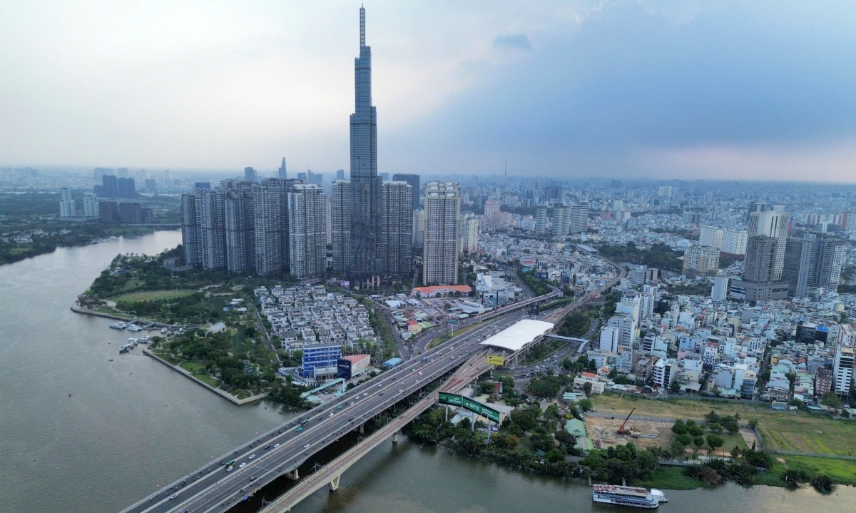
Landmark 81, the tallest building in Vietnam, is located in the Vinhomes Central Park project complex.
Currently, this skyscraper is a special symbol of Ho Chi Minh City when you can easily see this building from any direction in the central area of the city. This is a highlight in the eastern area of the city with the Saigon Bridge 1 and 2 complex, Landmark 81, Vincom Central Park complex and nearby is Saigon Pearl...
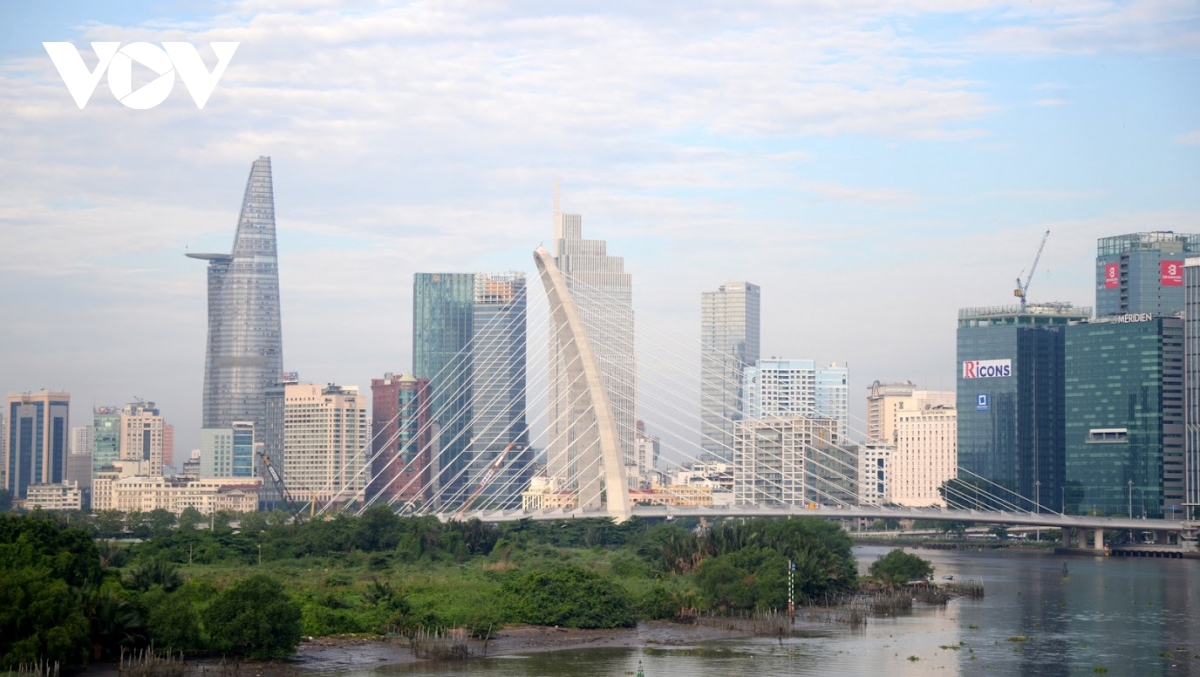
8. Ba Son Bridge: A highlight in the middle of the Saigon River, connecting the two banks
Ba Son Bridge (originally named Thu Thiem 2 Bridge) connects District 1 and Thu Duc City. The name Ba Son dates back to 1790, when Lord Nguyen Anh established a naval camp and built a "water workshop" on the Saigon River. Ba Son is known as the cradle of Vietnam's shipbuilding and ship repair industry. In addition, this name is also associated with the life of President Ton Duc Thang, and is the pride of the working class and the Vietnam Trade Union.
Ba Son Bridge is 1.4 km long with a cable-stayed design, starting at the intersection of Ton Duc Thang - Le Duan (District 1), ending at Tran Bach Dang Street (Route R1, Thu Duc City). The project is implemented in the form of BT (build - transfer), starting in 2015 and completed on April 30, 2022, after 7 years of construction.
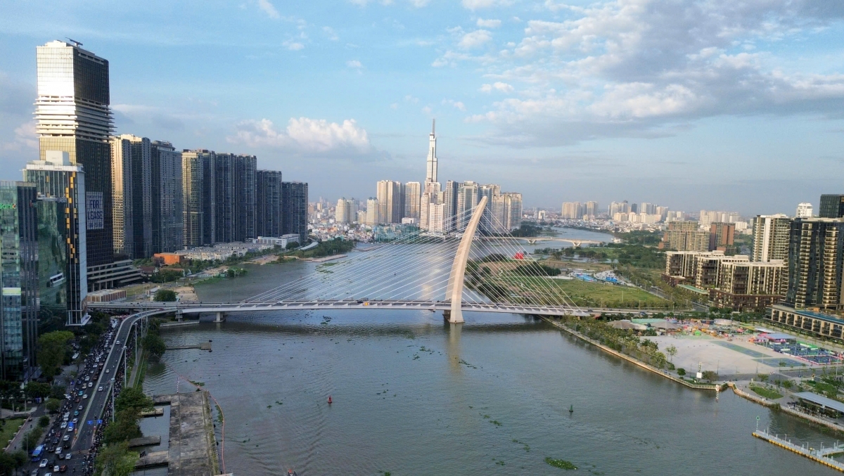
Ba Son Bridge: Highlight in the middle of Saigon River
With its unique design across the Saigon River, Ba Son Bridge has become a landscape highlight in the area with a strip of works stretching from Nha Rong Wharf, Bach Dang Wharf Park, Ba Son Bridge, Thu Thiem Bridge and Landmark 81... At night, Ba Son Bridge is sparkling with lights, like a thread connecting the two banks. This is also an important traffic project, helping to reduce traffic pressure on the Saigon River tunnel, Thu Thiem Bridge, Saigon Bridge...
9. Pham Van Dong Avenue: Modern inner-city route connecting to the airport
From a dirt road, Pham Van Dong Avenue has now become one of the most beautiful and modern inner-city roads in Ho Chi Minh City.
The route is nearly 14 km long, passing through Tan Binh, Go Vap, Binh Thanh districts and Thu Duc City. Of which, the section from Linh Xuan to Nguyen Thai Son roundabout (Go Vap district) is more than 12 km long, 30-65 m wide with 6-12 lanes. The remaining section is more than 1.5 km long, passing Gia Dinh Park, connecting to Tan Son Nhat airport gate and dividing into two branches: Hong Ha and Bach Dang streets, each 20 m wide with 3 lanes.
Pham Van Dong Avenue: Modern inner-city route connecting to the airport
The project has a total investment of about 340 million USD, implemented under the public-private partnership method (BT contract - build, transfer), and started construction in 2008. The first phase of the nearly 5 km long route was put into operation (from Nguyen Thai Son roundabout to Binh Trieu intersection, including Binh Loi bridge) in 2013 and the entire route was opened to traffic in 2016.
On the route, Binh Loi Bridge is the largest bridge across the Saigon River, more than 1 km long with 6 lanes in each direction. The bridge is designed with a Nielsen arch 35 m high, 28 m wide, 150 m long, and weighs 3,000 tons - a special technical item, the first time it was deployed for a bridge project in Vietnam at that time.
Not only has a beautiful and modern design, Pham Van Dong Avenue also plays an important role in promoting economic development and connecting trade in the Northeast gateway area of Ho Chi Minh City. This route connects Tan Son Nhat airport through Tan Binh, Binh Thanh, Go Vap districts, Thu Duc city to Ring Roads 2, Ring Road 3, and important national highways such as National Highways 1, 1K, 13 - connecting the key economic region of the Southeast.
In particular, the route has effectively solved the connection problem between Tan Son Nhat airport and the northeastern regions, contributing significantly to reducing traffic congestion and promoting the city's socio-economic development.
Ha Khanh/VOV-HCMC
Source: https://vov.vn/kinh-te/bat-dong-san/nhung-bieu-tuong-cua-tphcm-sau-50-nam-phat-trien-post1195863.vov


![[Photo] National Assembly Chairman attends the seminar "Building and operating an international financial center and recommendations for Vietnam"](https://vphoto.vietnam.vn/thumb/1200x675/vietnam/resource/IMAGE/2025/7/28/76393436936e457db31ec84433289f72)


Comment (0)