
Australia is now the world's fastest-moving continent, sitting atop the Indo-Australian tectonic plate, which is drifting at about 7 centimeters per year. That's about the speed at which human hair and fingernails grow.
According to the US National Oceanic and Atmospheric Administration (NOAA), Earth's tectonic plates move about 1.5 centimeters per year on average. Compared to that rate, Australia is far ahead of other continents as it continues to drift north.
Technically, the Indo-Australian plate includes not only the Australian continent and the island of Tasmania, but also covers parts of Papua New Guinea, New Zealand, and a large area of the Indian Ocean.
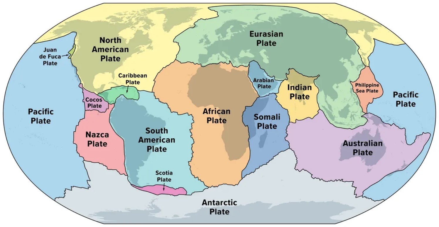
Map of Earth's major tectonic plates. (Photo: GI/Shutterstock)
It is predicted that in the next tens of millions of years, the Indo-Australian plate will likely collide with the bottom of the Eurasian plate in Southeast Asia and China, forming a new supercontinent that some scientists call "Austrasia".
This is not unprecedented in Earth's history. About 200 million years ago, Australia was part of Gondwana, the giant supercontinent that once covered much of the Southern Hemisphere. Gondwana included the Antarctic, South American, Indo-Australian and African plates, all of which were attached to each other. Meanwhile, Laurasia, the predecessor to today's Europe, Asia and North America, was in the Northern Hemisphere.
It is worth remembering that the Earth’s surface is always in motion – albeit very slowly. We do not feel this change in our daily lives, but the reality is that our planet is not as “still” as it appears.
Tectonic plates are constantly shifting: some are colliding, some are pulling apart. Instead of picturing the Earth as a solid mass of rock, we can imagine it as a cracked road surface moving slowly on a giant conveyor belt. Some cracks are widening, some are compressing – and the whole surface is moving, just too slowly to be noticed by the naked eye.
While this rate of movement is slow by human standards, it is still fast enough to affect modern technology. Satellite navigation systems like GPS rely on fixed coordinates to determine location. However, as tectonic plates move, the actual location of points on Earth begins to deviate from the locations recorded on maps.
Australia is a case in point: until 2017, the country was using a coordinate system dating back to 1994. Over the past 23 years, the continent has drifted 1.6 metres from its original position, forcing the system to be updated. In fact, Australia has officially “moved” about 1.8 metres to the northeast.
Ha Trang (according to IFL Science)
Source: https://www.congluan.vn/luc-dia-nao-cua-trai-dat-di-chuyen-nhanh-nhat-va-no-di-chuyen-ve-dau-post341603.html


![[OCOP REVIEW] Tu Duyen Syrup - The essence of herbs from the mountains and forests of Nhu Thanh](https://vphoto.vietnam.vn/thumb/402x226/vietnam/resource/IMAGE/2025/6/5/58ca32fce4ec44039e444fbfae7e75ec)


Comment (0)