
On the evening of July 26, due to the influence of a thunderstorm combined with a low pressure trough and a high-altitude wind convergence zone, many localities in the Red River Delta such as Ninh Binh, Hung Yen, Hanoi, Bac Ninh ... experienced very heavy rain.

The cause is a very large band of thunderstorms stretching from the Northern Delta to the midland and mountainous provinces in the North (such as Phu Tho, Lao Cai), spreading deep down to the North Central provinces such as Thanh Hoa, Nghe An, Ha Tinh ...


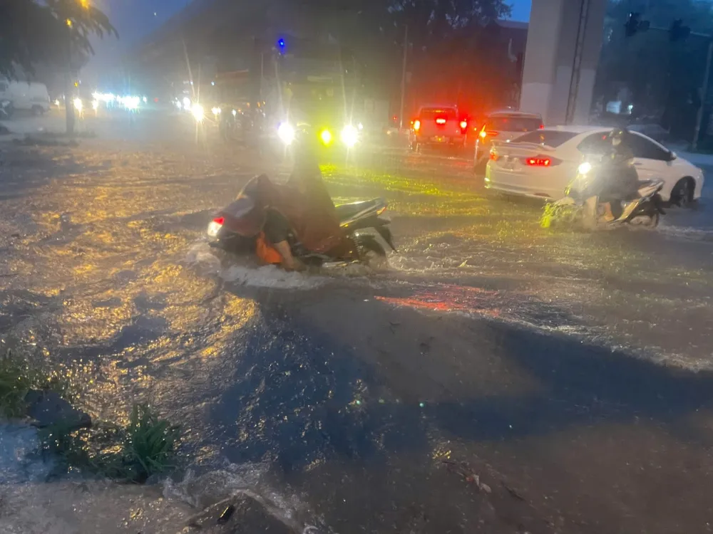
In Hanoi, torrential rain started at around 5 p.m. and lasted continuously for more than 2 hours, causing many streets and roads to be heavily flooded, with rainwater unable to drain away in time.
Flooded areas include Lang Ha, Thai Ha, Nguyen Luong Bang, Kham Thien, Le Duan, Nguyen Du, Minh Khai, Nguyen Trai, Pham Hung, Duong Dinh Nghe, Thang Long Boulevard...


Many residential areas in Yen Nghia, Tu Liem, Dai Mo wards... water flooded into people's houses. Updated data on the automatic rain gauge system Vrain, the average rainfall in Hanoi in just 2 hours is 94mm.

 are heavily flooded, Quang Trung road to Ba La is deeply flooded.")
On the same day, rain also appeared in many localities. According to data from the automatic rain gauge system Vrain, the rainfall in Tan Tien (Lao Cai) was 101mm, Muong Pon (Dien Bien) was 116mm, Muong Mo (Lai Chau) was 149.2mm. In Thai Nguyen, Tuyen Quang, Son La, there was heavy rain.

In the Central region, rain continued in Thanh Hoa 104mm; Nghe An 77mm; Ha Tinh 61mm; Quang Tri 190.6mm; and Hue, Da Nang, Quang Ngai all over 68mm.
According to the National Center for Hydro-Meteorological Forecasting, the rainy area is gradually shifting from the North to the Central region. From July 28, heavy rain in the Central Central region will gradually decrease, but unstable weather conditions are expected to persist in some mountainous areas in the North and Central Highlands.
Source: https://www.sggp.org.vn/ha-noi-mua-nhu-trut-nuoc-hon-2-gio-nhieu-tuyen-pho-ngap-sau-post805615.html


![[Photo] National Assembly Chairman attends the seminar "Building and operating an international financial center and recommendations for Vietnam"](https://vphoto.vietnam.vn/thumb/1200x675/vietnam/resource/IMAGE/2025/7/28/76393436936e457db31ec84433289f72)


Comment (0)