
According to the National Center for Hydro-Meteorological Forecasting, on July 27, heavy rain, flash floods, and landslides occurred in many areas.
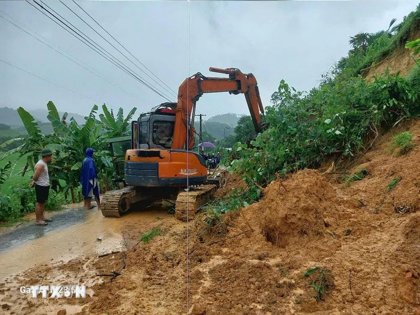
A landslide in Thanh Hoa province. (Photo: VNA)
Flash flood warning in many areas
The National Center for Hydro-Meteorological Forecasting said that from 8:30 a.m. to 2:30 p.m. on July 27, the provinces of Lai Chau, Dien Bien , Son La, and Quang Tri will continue to have rain with common accumulated rainfall such as Dien Bien , Lai Chau, Son La from 5-10 mm, some places over 20 mm; Quang Tri from 10-30 mm, some places over 60 mm.
Risk of flash floods on small rivers and streams, landslides on steep slopes in many communes/wards: Ta Tong; Bum Nua, Bum To, Dao San, Khong Lao, Muong Mo, Pa U, Thu Lum, Tua Sin Chai (Lai Chau province); Muong Luan, Muong Pon, Na Sang, Tia Dinh; Chieng Sinh, Muong Cha, Muong Mun, Na Tau, Pu Nhung, Tuan Giao (Dien Bien province); Binh Thuan, Bo Sinh, Co Ma, Huoi Mot, Nam Ty, Phieng Cam, Quynh Nhai, Song Khua, Song Ma, Ta Khoa, To Mua, Yen Chau; Chieng So, Muong E, Muong Lam, Muong Lan, Muong Leo, Nam Lau, Chieng Coi, Pung Banh, Sop Cop, Xim Vang (Son La province); A Doi, Dakrong, Khe Sanh, Lao Bao, Lia, Ta Rut, Tan Lap; Ba Long, Huong Hiep, Huong Phung, La Lay (Quang Tri province).
Warning level of natural disaster risk due to flash floods, landslides, land subsidence due to heavy rain or level 1 flow.
From 7:00 a.m. on July 26 to 7:00 a.m. on July 27, the above provinces had moderate to heavy rain, and locally very heavy rain such as: Ta Tong 2 (Lai Chau) 109.4mm; Luan Gioi (Dien Bien) 148.8mm; Chieng En (Son La) 162mm; Huong Loc (Quang Tri) 235mm.
Soil moisture models show that some areas in the above provinces are close to saturation (over 85%) or have reached saturation.
Flash floods and landslides can have very negative impacts on the environment, threaten people's lives; cause local traffic congestion, affect the movement of vehicles; destroy civil and economic works, causing damage to production and socio-economic activities.
The hydrometeorological agency recommends that local authorities pay attention to reviewing bottlenecks and vulnerable locations in the area to take preventive and response measures.
Thanh Hoa to Da Nang, some places have rain over 70mm
According to the National Center for Hydro-Meteorological Forecasting, on the day and night of July 27, the area from Thanh Hoa to Da Nang will have scattered showers and thunderstorms, with some places experiencing heavy rain with rainfall of 15-40mm, and some places experiencing over 70mm (rain concentrated in the afternoon and night).
The Central Highlands and the Southeast have scattered showers and thunderstorms, locally heavy rain with rainfall from 10-30mm, locally over 50mm (rain concentrated in the afternoon and evening).
"Thunderstorms are likely to cause tornadoes, lightning, hail and strong gusts of wind. Localized heavy rains can cause flash floods on small rivers and streams, landslides on steep slopes and flooding in low-lying areas. Warning level 1 of natural disaster risk due to tornadoes, lightning and hail," noted Head of the Weather Forecast Department Nguyen Van Huong.
On the night of July 26 and morning of July 27, the Northern region, the area from Thanh Hoa to Da Nang and the Central Highlands will have scattered showers and thunderstorms, with heavy rain in some places.
Rainfall from 7:00 p.m. on July 26 to 9:00 a.m. on July 27 was over 50mm in some places, such as Nam Ty station (Son La) 211.8mm, Luan Gioi station (Dien Bien) 135.4mm, Ta Phoi station (Lao Cai) 88.2mm, Ta Tong 2 station (Lai Chau) 76mm, Song Ma station (Son La) 153mm, Ta Rut station (Quang Tri) 58.2mm, Ia Pior station (Gia Lai) 61mm./.
According to VNA
Source: https://baothanhhoa.vn/canh-bao-nguy-co-lu-quet-sat-lo-tai-4-tinh-bac-bo-va-trung-bo-256211.htm


Comment (0)