


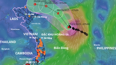
Average map of storm and tropical depression paths in the East Sea
According to the Center for Hydro-Meteorological Forecasting, on the morning of September 6, a tropical depression (TLD) is active in the eastern sea of the North East Sea, with a strong intensity of level 7, and is likely to strengthen into a storm in the evening of September 6.
It is forecasted that in the evening and night of September 6, this tropical depression will strengthen into a storm, and will be the 16th storm in the Northwest Pacific region, the 7th storm active in the East Sea since the beginning of 2025. According to the international name list, it will be Tapah.
Currently, forecasts from international storm forecasting centers, as well as the National Center for Hydro-Meteorological Forecasting, predict that storm No. 7 will make landfall in Guangdong province (China) on September 8, with an intensity that could reach level 10-11, gusting to level 13-14.
It is likely that from the afternoon and night of September 9-11, the post-storm circulation of storm No. 7 will cause widespread heavy rain in the North, focusing on the midland and mountainous areas of the Northeast.
Thu Cuc
Source: https://baochinhphu.vn/bao-so-7-sap-di-vao-bien-dong-hoan-luu-co-the-gay-mua-lon-tai-cac-tinh-phia-bac-102250906164112628.htm

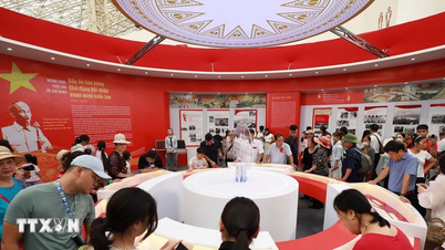
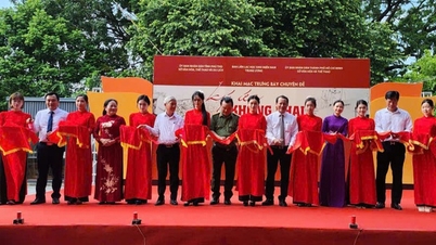
![[Photo] Impressive display booths of provinces and cities at the Exhibition 80 years of the Journey of Independence - Freedom - Happiness](https://vphoto.vietnam.vn/thumb/1200x675/vietnam/resource/IMAGE/2025/9/7/cd63e24d8ef7414dbf2194ab1af337ed)


![[Photo] Prime Minister Pham Minh Chinh attends the 80th anniversary of the founding of Voice of Vietnam Radio Station](https://vphoto.vietnam.vn/thumb/1200x675/vietnam/resource/IMAGE/2025/9/7/abdcaa3d5d7f471abbe3ab22e5a35ec9)


![[Photo] General Secretary To Lam attends the 55th anniversary of the first television program broadcast](https://vphoto.vietnam.vn/thumb/1200x675/vietnam/resource/IMAGE/2025/9/7/8b8bd4844b84459db41f6192ceb6dfdd)


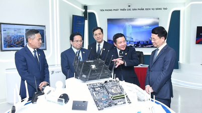
![[Highlight] VIMC's mark at the National Achievement Exhibition](https://vphoto.vietnam.vn/thumb/402x226/vietnam/resource/IMAGE/2025/9/7/932133a54d8b4becad48ef4f082f3eea)


![[COMING UP] Workshop: Resolving concerns for Business Households about eliminating lump-sum tax](https://vphoto.vietnam.vn/thumb/402x226/vietnam/resource/IMAGE/2025/9/7/5627bb2d0c3349f2bf26accd8ca6dbc2)


Comment (0)