
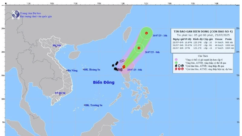
(Photo: National Center for Hydro-Meteorological Forecasting)
According to the National Center for Hydro-Meteorological Forecasting, at 4:00 a.m., the eye of the storm was located at approximately 16.8 degrees north latitude; 120.3 degrees east longitude, in the area west of Lu Island (Philippines). The strongest wind near the eye of the storm was level 9-10 (75-102 km/h), gusting to level 12; moving northeast at a speed of approximately 10 km/h.
It is forecasted that by 4:00 a.m. on July 26, storm No. 4 will move northeast at about 20-25 km/h and gradually weaken over the northeastern sea area of Lu Dong Island. By 4:00 p.m. on the same day, the storm will continue to move northeast at 25-30 km/h and gradually weaken into a low pressure area.
At sea, today (July 25), the eastern sea area of the northern East Sea has strong winds of level 7-8, near the storm center strong winds of level 9-10, gusts of level 12; waves 4-6m high. The sea is very rough. Ships operating in the above-mentioned dangerous areas are likely to be affected by storms, whirlwinds, strong winds, and large waves.
NDS
Source: https://baothanhhoa.vn/bao-so-4-do-bo-vao-phia-tay-dao-lu-dong-du-bao-suy-yeu-vao-chieu-mai-255999.htm


Comment (0)