
Location and direction of storm No. 3 at 4:00 a.m. on July 22 - Photo: NCHMF
According to the National Center for Hydro-Meteorological Forecasting at 6:00 a.m. this morning, the center of storm No. 3 is about 170 km southwest of Quang Ninh, about 60 km southeast of Hai Phong, about 50 km east of Hung Yen, and about 70 km northeast of Ninh Binh. The strongest wind is level 9-10 (89-102 km/h), gusting to level 13.
Forecast in the next 3 hours, the storm will move in the West Southwest direction, speed about 15 km/h. The coastal area of Hai Phong - Hung Yen is the area with the strongest wind at this time. Note that the impact of strong wind is increased in urban areas with many high-rise buildings.
According to the National Center for Hydro-Meteorological Forecasting, at 4:50 this morning, due to the influence of storm No. 3 (Wipha), Ninh Binh, Thanh Hoa and Nghe An provinces are experiencing the heaviest rain. Along the coast of Quang Ninh, Hai Phong, Hung Yen and Ninh Binh provinces, the wind is very strong.
According to Tuoi Tre Online reporters at 6am, in Thanh Hoa area there is moderate rain, sometimes heavy rain with wind, but not strong.
Meanwhile, in Hanoi at 6:10 this morning, the weather was light and windy, no rain, many breakfast restaurants were closed, and the streets were sparsely populated.
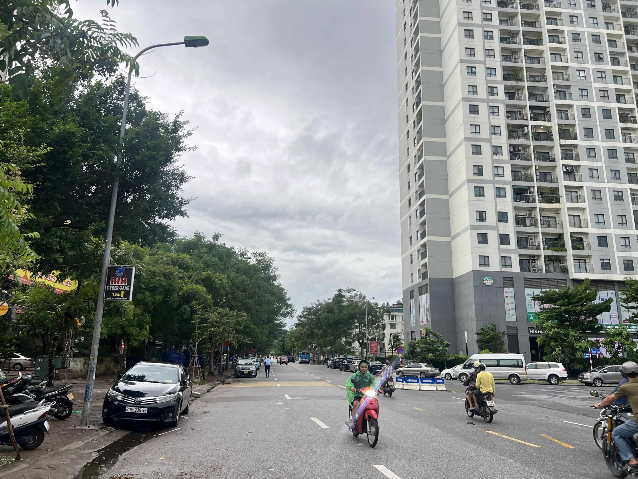
Photo taken in Hanoi at 6:10 this morning, the streets were sparsely populated - Photo: PHAM TUAN
Hung Yen suddenly sunny
Early morning of July 22, Hung Yen coastal area had strong wind and rain. Many areas in Dong Chau commune experienced power outage since the night of July 21.
In a quick statement to Tuoi Tre Online , Mr. Do Manh Cuong - Vice Chairman of Dong Chau Commune People's Committee confirmed the power outage and said the initial cause was determined to be an incident related to the power line, due to strong winds.
“This is not a power outage or a widespread incident,” he said.
The Traffic Safety Committee of Hung Yen province has also sent a notice to relevant authorities, commune and ward People's Committees, and units about proactively responding to storm No. 3 at cross-river passenger terminals. Accordingly, all cross-river passenger terminals in the province will stop operating from 6 p.m. on July 21.
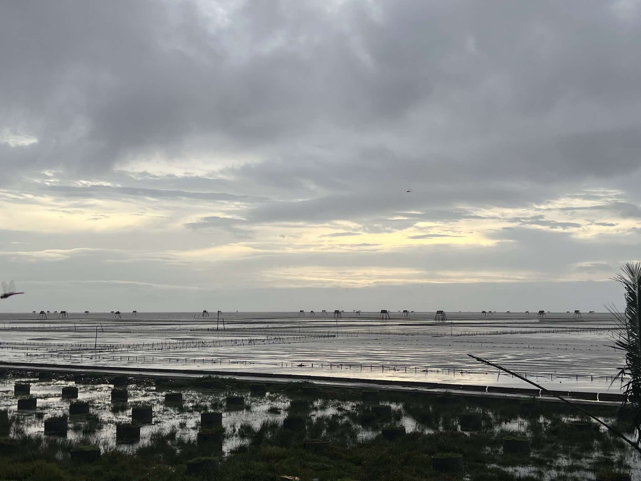
Hung Yen suddenly has sunshine, calm sea and wind at 6:40 am - Photo: HONG QUANG
Deputy Director of the Department of Education and Training of Hung Yen province, Ms. Ha Thi Thu Phuong, said that in the face of the complicated developments of storm No. 3 - in which Hung Yen is a locality directly affected, to ensure absolute safety for children, staff, teachers and workers.
From July 22, the province will not organize to pick up children to preschools until the storm passes and the situation is safe again.
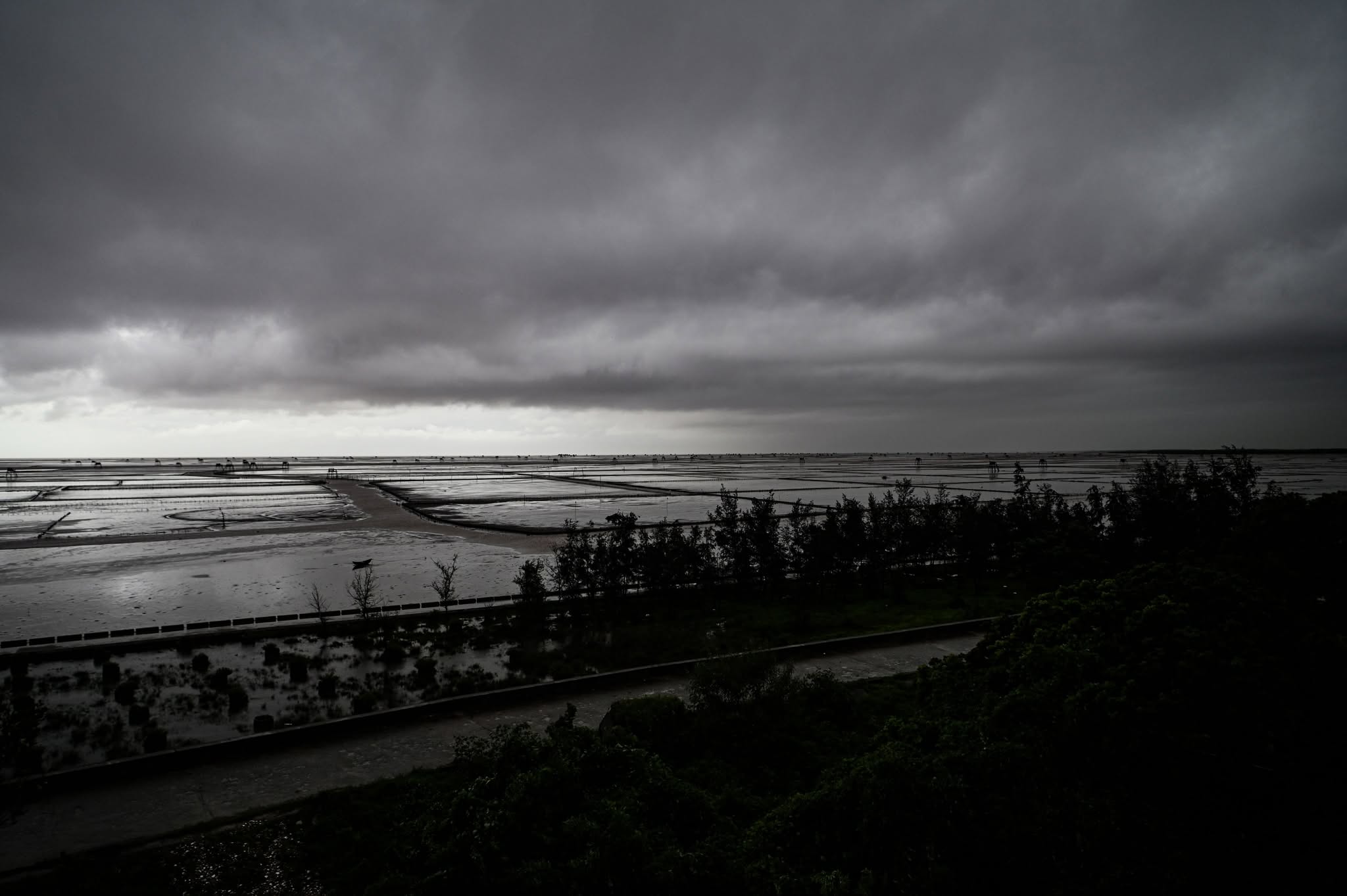
Thunderstorm before storm Wipha arrives at Hung Yen coast in the early morning of July 22 - Photo: HONG QUANG
Images before storm number 3 made landfall
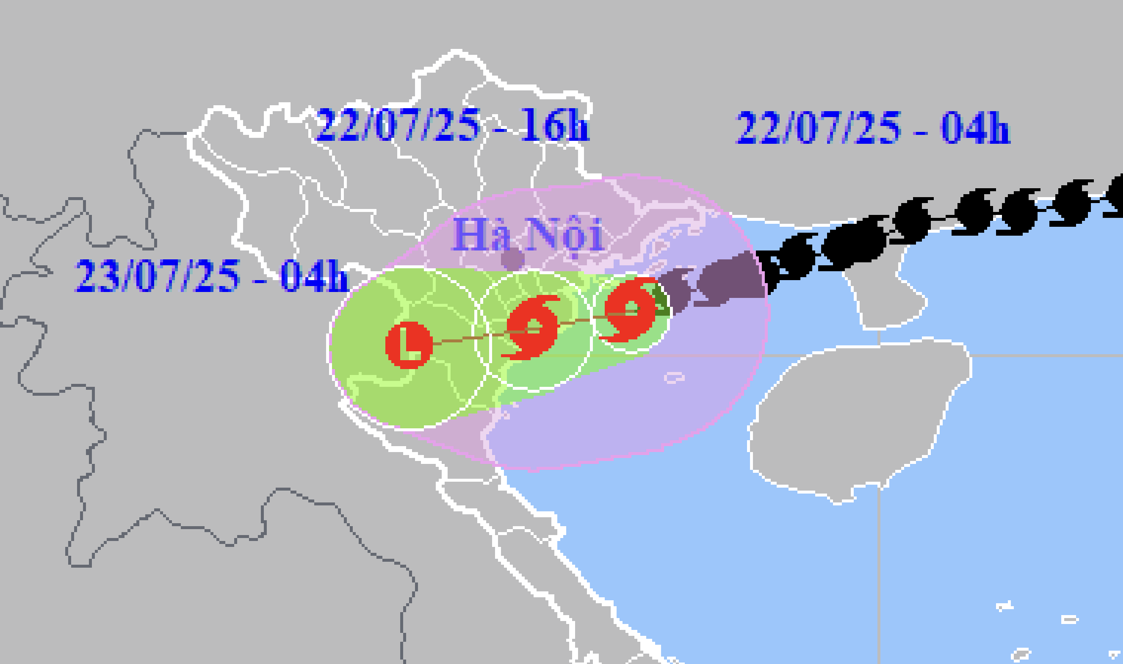
At 4:00 a.m. on July 22, the center of storm No. 3 (Wipha) was about 140km west southwest of Quang Ninh, about 70km east of Hai Phong, about 80km east northeast of Hung Yen, and about 110km northeast of Ninh Binh.
The strongest wind near the center of storm No. 3 is level 9-10 (75-102km/h), gusting to level 13.
Hai Phong at 6am no rain, light wind - Photo: TIEN NGUYEN
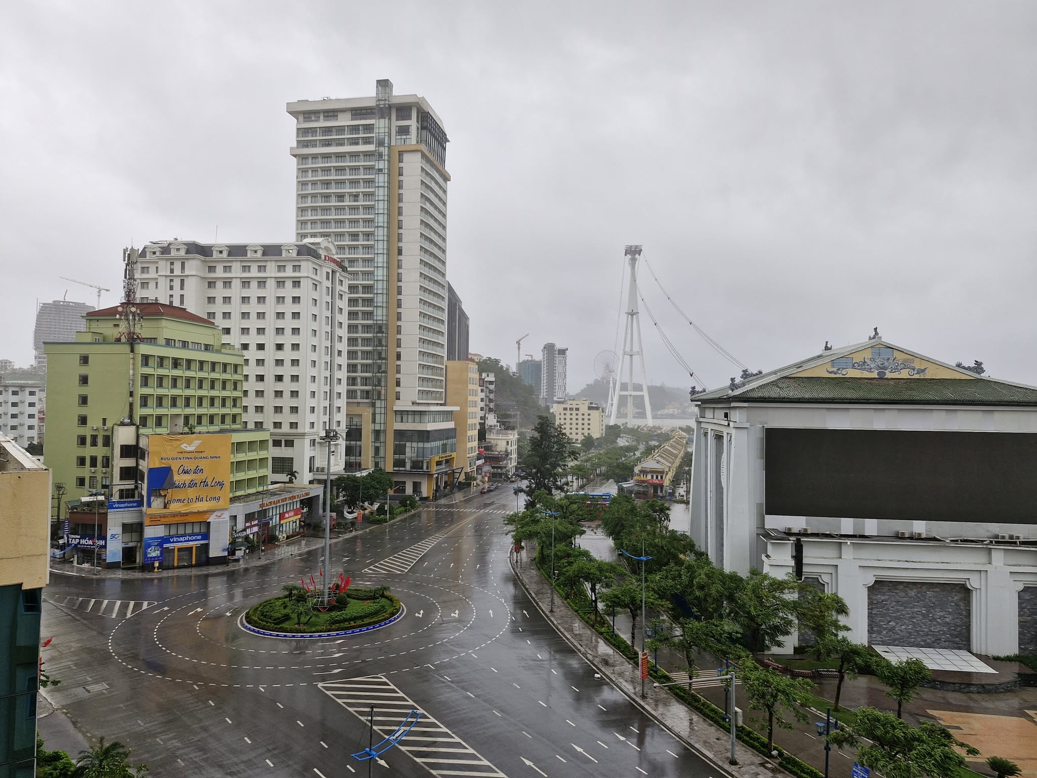
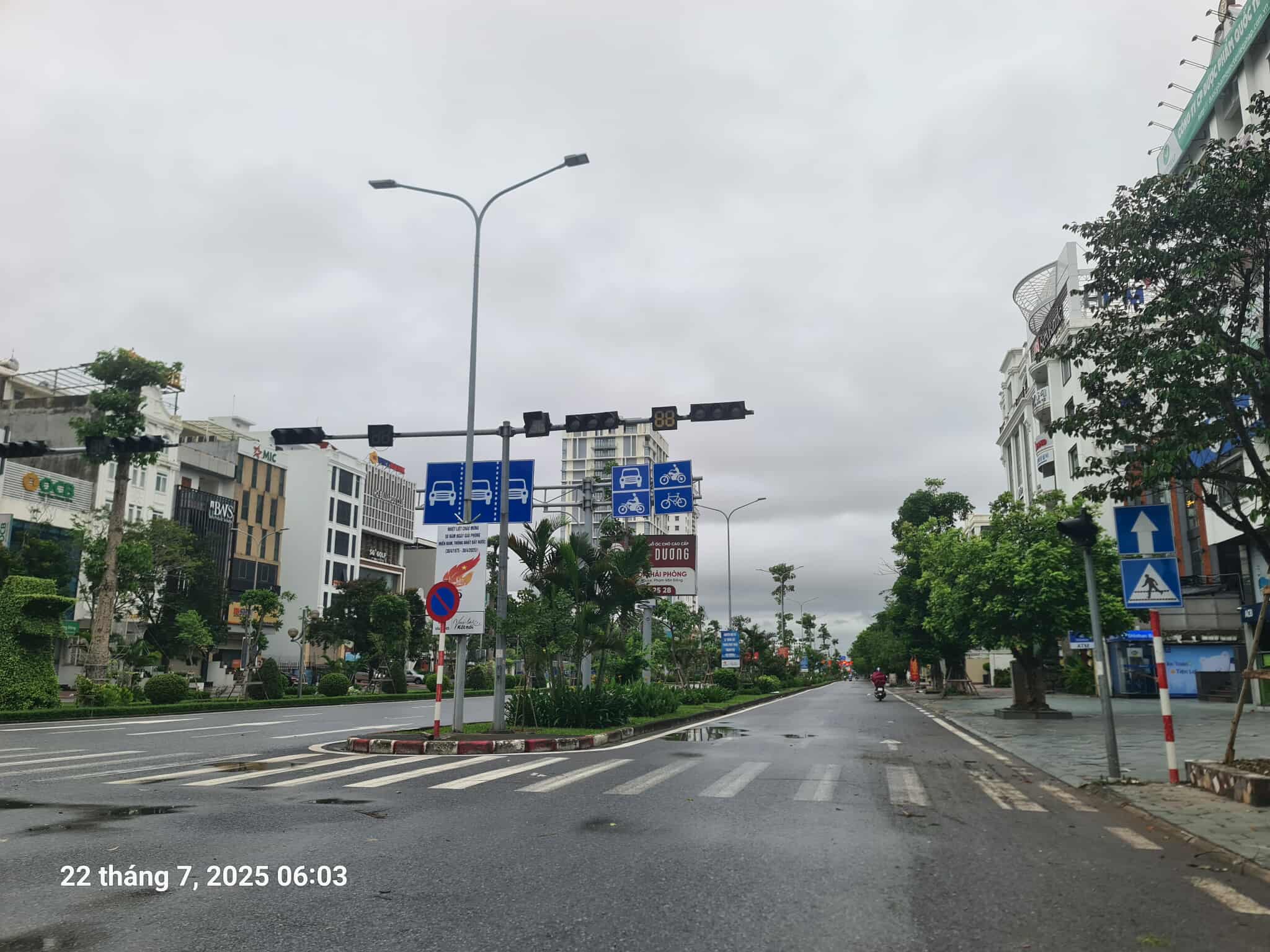
Photo taken on Ha Long street at 6:10 am, only light rain, almost no wind - Photo: NAM TRAN

In Hanoi, at 5:30 a.m., the wind was light and it was drizzling. On Hoang Quoc Viet Street, a small tree fell onto the street - Photo: CHI TUE
Due to the influence of storm No. 3, many coastal and inland areas have strong winds, Bach Long Vi level 10, gust level 12; Co To level 8, gust level 11; Cat Ba level 6, gust level 8; Cua Ong level 9, gust level 12; Bai Chay level 8, gust level 9; Quang Ha level 8; Tien Yen has strong winds level 7, gust level 9; Thai Binh station has strong winds level 7, gust level 8; Mong Cai has strong winds level 6, gust level 9; Phu Lien has strong winds level 6, gust level 8...
The Northern Delta and coastal areas, Thanh Hoa and Nghe An have moderate to very heavy rain, with common rainfall of 50-100mm, in some places over 130mm.
It is forecasted that from morning to noon today, the storm will approach the Hai Phong - Ninh Binh sea area and then enter our mainland around noon to afternoon today.
Due to the influence of storm No. 3, in coastal areas from Quang Ninh to Nghe An, there are strong winds of level 7-8, near the storm's eye, level 9-10, gusting to level 13.
Inland areas of the provinces/cities of Hai Phong, Hung Yen, Bac Ninh, Hanoi, Ninh Binh and Thanh Hoa have strong winds of level 6, gusting to level 7-8.
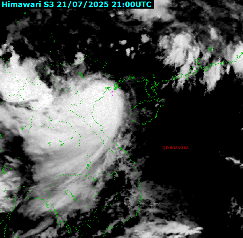
Satellite image of storm No. 3 at 4:00 a.m. on July 22 - Photo: NCHMF
The northern Gulf of Tonkin (including the special zones of Bach Long Vi, Co To, Van Don, Cat Hai, and Hon Dau Island) has strong winds of level 7-8, and winds near the storm's eye of level 9-10, gusting to level 13.
The southern Gulf of Tonkin (including Hon Ngu Island) has strong winds of level 6-7, near the storm center level 8, gusts of level 11, waves 2-4m high.
The coastal areas of Hung Yen - Quang Ninh have storm surges of 0.5-1m high. Water levels in Ba Lat (Hung Yen) are 2.4-2.6m high, Hon Dau (Hai Phong) are 3.9-4.3m high, Cua Ong (Quang Ninh) are 4.6-5m high and Tra Co (Quang Ninh) are 3.6-4m high. There is a high risk of flooding in coastal areas and river mouths on the afternoon of July 22.
From early this morning until July 23, in the Northern Delta region, Thanh Hoa and Nghe An, there will be heavy to very heavy rain and thunderstorms with common rainfall of 200-300mm, locally over 500mm.
Other places in the Northern region and Ha Tinh have moderate rain, heavy rain, locally very heavy rain and thunderstorms with common rainfall of 70-150mm, locally over 250mm.
Beware of heavy rain over 150mm in 3 hours causing flash floods, landslides in mountainous areas, flooding in low-lying areas.
Tuoitre.vn
Source: https://tuoitre.vn/bao-so-3-ninh-binh-thanh-hoa-va-nghe-an-dang-mua-to-nhat-20250721233604079.htm


![[Photo] National Assembly Chairman attends the seminar "Building and operating an international financial center and recommendations for Vietnam"](https://vphoto.vietnam.vn/thumb/1200x675/vietnam/resource/IMAGE/2025/7/28/76393436936e457db31ec84433289f72)


Comment (0)