

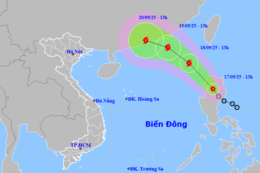
According to the National Center for Hydro-Meteorological Forecasting, as of 1 p.m. this afternoon, September 17, the center of the tropical depression was at about 17.3 degrees North latitude; 121.3 degrees East longitude, in the northwest area of Luzon Island (Philippines). The strongest wind near the center of the tropical depression is level 7 (50-61 km/h), gusting to level 9. Moving northwest at a speed of about 15 km/h.
In the next 24 hours, the tropical depression will maintain its direction and move faster at a speed of 15-20km/hour, entering the East Sea and is likely to strengthen into a storm.
At 1 p.m. on September 18, the center of the storm was located in the northeastern sea area of the North East Sea with wind speed of level 8, gusting to level 10. If the tropical depression strengthens into a storm, this will be the 8th storm in the East Sea during the 2025 storm season.
In the next 24 hours, the storm will continue to move northwest at about 15km/h, with the possibility of strengthening. At 1pm on September 19, the center of the storm will be located in the northeastern sea area of the North East Sea, about 250km east-southeast of Hong Kong (China); wind speed will increase, reaching level 8-9, gusting to level 11.
From the next 48 to 72 hours, the storm will move mainly in the West Northwest direction, about 10km per hour, with little change in intensity.
Due to the influence of the tropical depression that has strengthened into a storm, from this evening, the northeastern sea area of the North East Sea will have winds gradually increasing to level 6-7, gusting to level 9; near the center of the storm, winds will be level 8, gusting to level 10, waves 2.5-4.5m high. The sea will be rough. Ships operating in the above-mentioned dangerous areas are likely to be affected by storms, whirlwinds, strong winds, and large waves.
PV (synthesis)Source: https://baohaiphong.vn/ap-thap-nhiet-doi-sap-vao-bien-dong-co-the-manh-len-thanh-bao-so-8-trong-dem-nay-521039.html


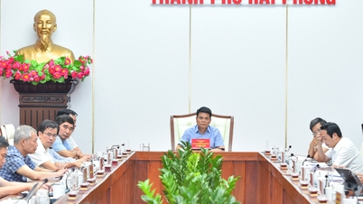
![[Photo] General Secretary To Lam chairs a working session with the Standing Committee of the Government Party Committee](https://vphoto.vietnam.vn/thumb/1200x675/vietnam/resource/IMAGE/2025/9/17/cf3d855fdc974fa9a45e80d380b0eb7c)

![[Photo] Science and Technology Trade Union honors exemplary workers and excellent union officials](https://vphoto.vietnam.vn/thumb/1200x675/vietnam/resource/IMAGE/2025/9/17/842ff35bce69449290ec23b75727934e)


Comment (0)