
 |
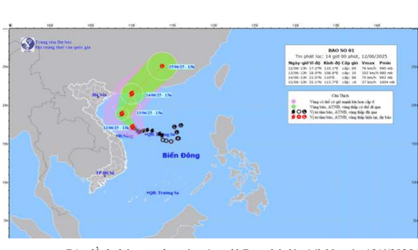
| Forecast map of trajectory and intensity of storm No. 1. |
In the next 24 to 72 hours, the storm will continue to move northwest and then gradually shift to the northeast with slight changes in intensity. It is forecasted that by 1:00 p.m. on June 13, the storm center will be located in the North East Sea, about 250 km east-northeast of the Hoang Sa archipelago, with strong winds of level 9 to level 10, gusting to level 12. By June 14, the storm will move northeast with winds of level 8 to level 9, gusting to level 11, and is likely to continue to weaken as it moves further into the northeastern waters of the East Sea on June 15.
Due to the storm's influence, the North East Sea area has strong winds of level 8 to level 9, gusting to level 11 to level 12; rough seas, waves from 4 to 6 m high. The sea area from Ba Ria - Vung Tau to Ca Mau, including the sea area of Go Cong, has strong southwest winds of level 5 to level 6, gusting to level 7 to level 8; waves from 2 to 3.5 m high, rough seas.
On land, Tien Giang province will be cloudy this afternoon and tonight with scattered showers and thunderstorms. During thunderstorms, be on guard against tornadoes, lightning and strong gusts of wind. The southwest wind will blow gently at level 2 to level 3.
CT
Source: https://baoapbac.vn/xa-hoi/202506/bao-so-1-co-xu-huong-tiep-tuc-di-chuyen-ve-phia-tay-bac-1045170/


Comment (0)