
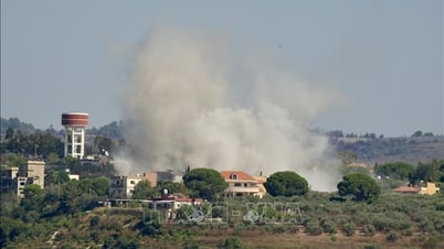
Accordingly, at 7:00 a.m. on June 10, the center of the tropical depression was at about 15.7 degrees north latitude; 115.6 degrees east longitude, about 360 km east-southeast of Hoang Sa archipelago. The strongest wind near the center of the tropical depression was level 6 (39-49 km/h), gusting to level 8; moving slowly westward at a speed of about 5 km/h.
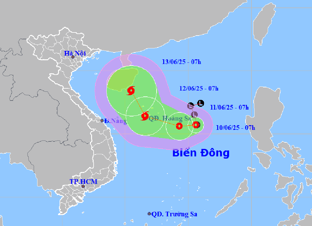 |
| Location and forecast direction of tropical depression in the East Sea. |
It is forecasted that by 7:00 a.m. on June 11, the tropical depression will be about 240 km east-southeast of Hoang Sa archipelago, with winds of level 7, gusts of level 9, moving west and likely to strengthen. It is forecasted that the tropical depression will continue moving west, and by 7:00 a.m. on June 12, it is likely to strengthen into a storm, with winds of level 8-9, gusts of level 11.
Due to the influence of the tropical depression, the northern East Sea (including the Hoang Sa archipelago) and the northern central East Sea will have thunderstorms, strong winds of level 6-7, gusts of level 9, waves 2-4m high, rough seas. The sea area of Khanh Hoa (including the sea area of Truong Sa archipelago) will have showers and strong thunderstorms; strong southwest winds of level 5, level 6, gusts of level 7-8, waves 2-3m high, rough seas. Ships in the dangerous area should be aware of the high risk of thunderstorms, tornadoes, strong winds and big waves.
H.D
Source: https://baokhanhhoa.vn/xa-hoi/202506/ap-thap-nhiet-doi-tren-bien-dong-co-kha-nang-manh-len-thanh-bao-a2d5b08/


![[Photo] President Luong Cuong talks on the phone with South Korean President Lee Jae Myung](https://vphoto.vietnam.vn/thumb/1200x675/vietnam/resource/IMAGE/2025/6/13/eee54a4c903f49bda277272b1dda68e8)


Comment (0)