

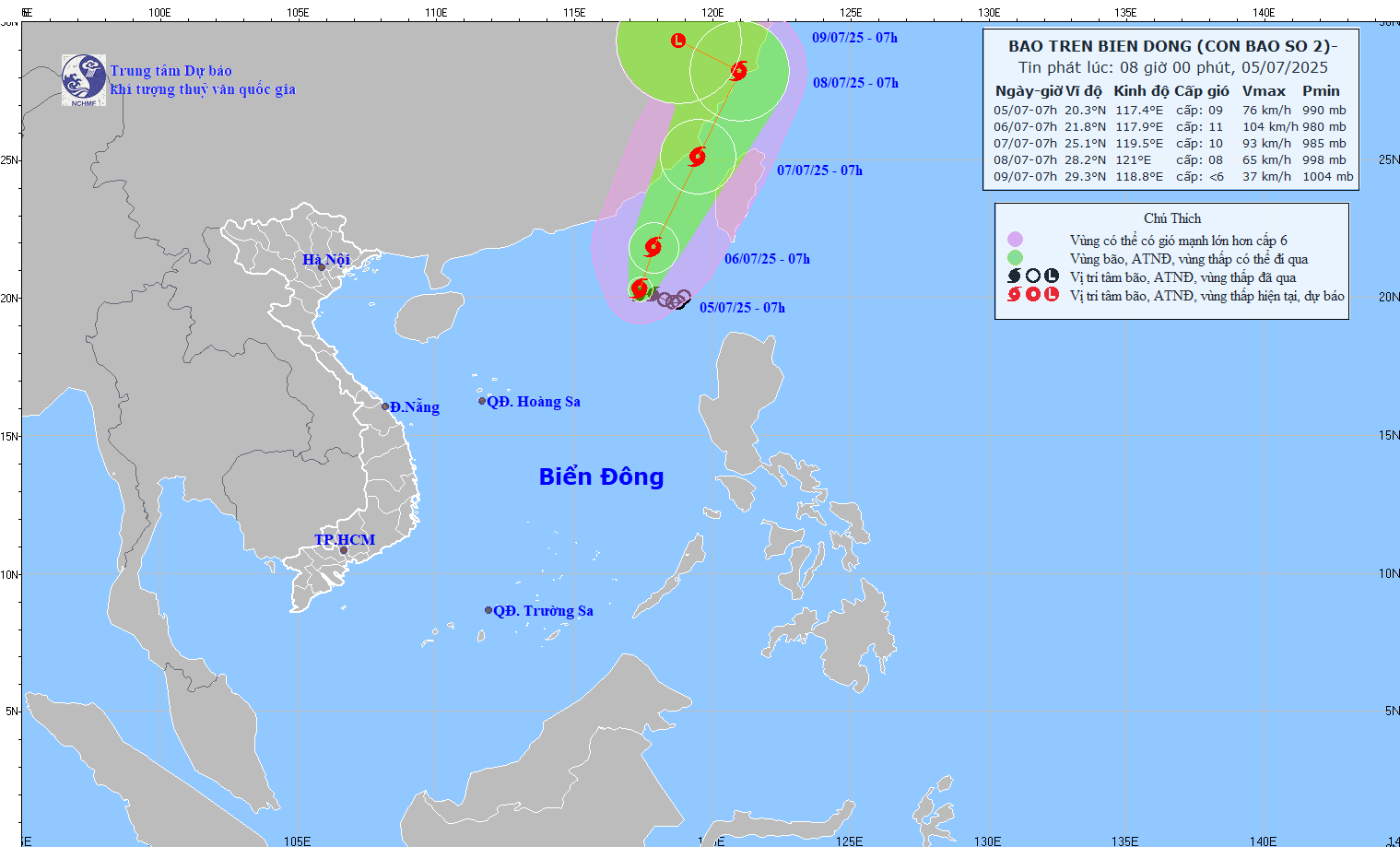
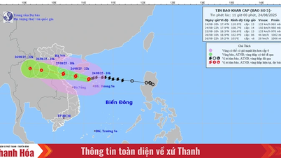
Forecast of storm No. 2's path at 8:00 a.m. on July 5.
At 7:00 a.m. on July 5, the center of the storm was at about 20.3 degrees North latitude; 117.4 degrees East longitude; intensity level 8-9 (62-88 km/h), gust level 11. The storm moved slowly in the West Northwest direction, speed about 5-10 km/h.
Forecast at 7am on July 6, storm No. 2 is moving north at a speed of 5-10km/h and is likely to strengthen. The center of the storm is located at 21.8 degrees north latitude - 117.9 degrees east longitude, in the northeastern waters of the East Sea. Intensity level 10-11, gust level 13.
Around the morning of July 7, the storm moved in a North-Northeast direction at a speed of about 15km/h, the center of the storm was located in the sea of Fujian province (China) and was forecast to continue moving into the mainland of this country.
Storm forecast for the next 24-72 hours.
From the next 72 to 96 hours, storm No. 2 will move in the West Northwest direction at a speed of about 10km/h and gradually weaken into a low pressure area.
Due to the impact of the storm, the northeastern sea area of the North East Sea has stormy rain, strong winds of level 7-8, the area near the storm's center has levels 9-11, gusting to level 13. The sea is rough, with waves 4-6m high. Ships operating in the dangerous area are at high risk of being affected by storms, whirlwinds, strong winds and big waves.
NDS
Source: https://baothanhhoa.vn/ap-thap-nhiet-doi-da-manh-len-thanh-bao-so-2-254057.htm
![[Photo] Phu Quoc: Propagating IUU prevention and control to the people](https://vphoto.vietnam.vn/thumb/1200x675/vietnam/resource/IMAGE/2025/8/24/f32e51cca8bf4ebc9899accf59353d90)

![[Photo] Party and State leaders meet with representatives of all walks of life](https://vphoto.vietnam.vn/thumb/1200x675/vietnam/resource/IMAGE/2025/8/24/66adc175d6ec402d90093f0a6764225b)


Comment (0)