
The National Center for Hydro-Meteorological Forecasting said that on the day and night of July 23, the North will have scattered showers and thunderstorms, locally heavy rain with rainfall from 15-30mm, locally over 80mm, with the possibility of tornadoes, lightning, hail and strong gusts of wind during thunderstorms.
From July 24 to 25, the Northern region, Thanh Hoa and Nghe An are likely to experience widespread heavy rain with common rainfall of 60-120mm, locally over 200mm.
Warning of risk of heavy rain over 90mm in 3 hours, thunderstorms with possibility of tornadoes, lightning, hail and strong gusts of wind.
")
Level of natural disaster risk due to heavy rain, tornadoes, lightning, hail: level 1. Heavy rain can cause flooding in low-lying areas, urban and industrial areas; flash floods on small rivers and streams, landslides on steep slopes (real-time warning information on areas at risk of flash floods and landslides is provided online on the website of the Department of Hydrometeorology at: https://luquetsatlo.nchmf.gov.vn and in separate bulletins warning of flash floods and landslides).
On the night of July 22 and early morning of July 23, the North had moderate rain, localized heavy rain. The rainfall from 7:00 p.m. on July 22 to 3:00 a.m. on July 23 was over 40mm in some places such as: Pu Danh station (Son La) 73.8mm, Cao Pha station ( Lao Cai ) 67mm, Lung Van station (Phu Tho) 46mm...
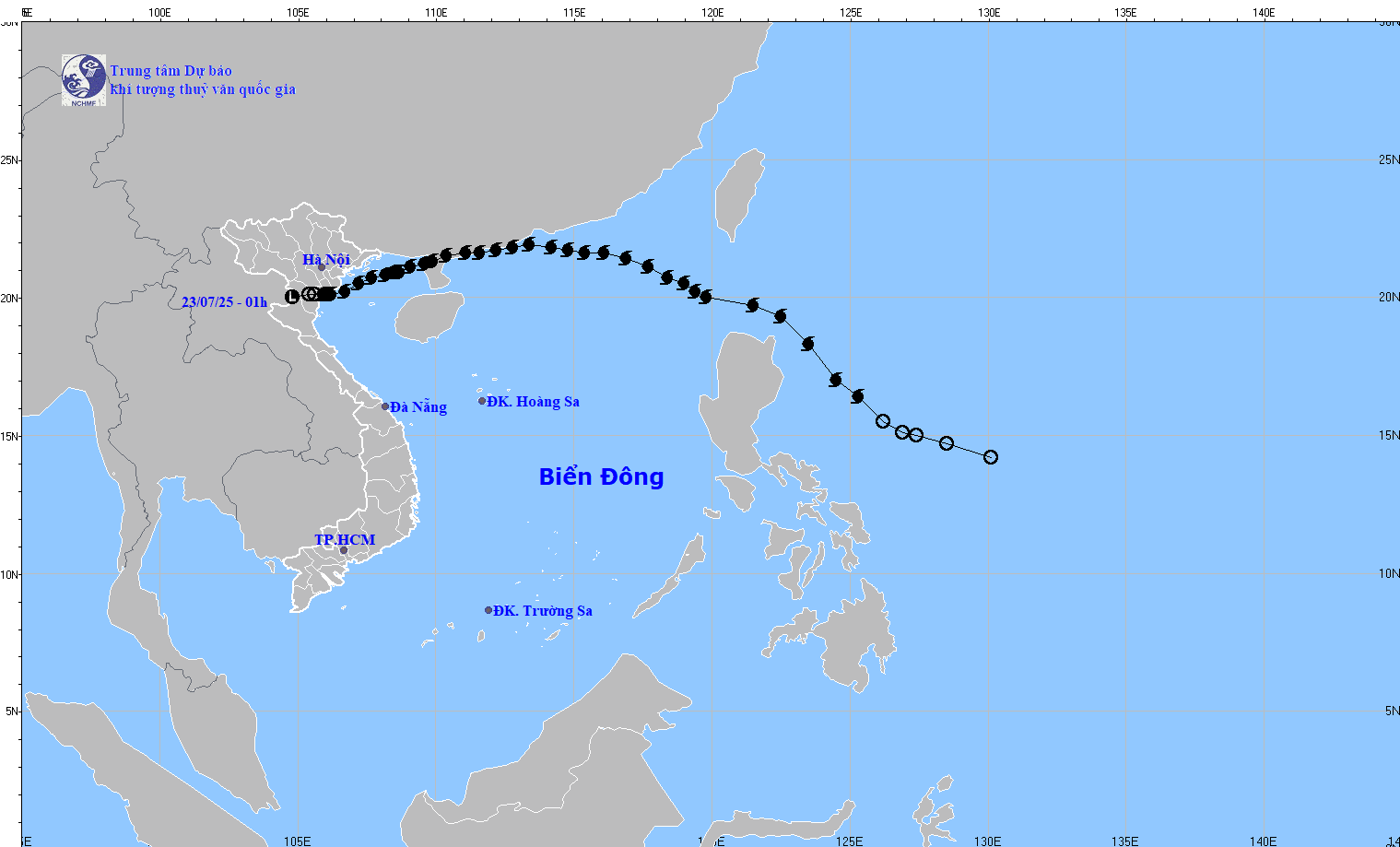
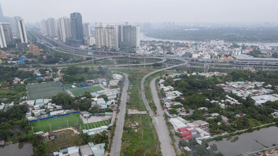
Flash flood and landslide warning in 5 provinces of the North and North Central regions
The National Center for Hydro-Meteorological Forecasting informed that from 5:30 a.m. to 10:30 a.m. on July 23, the provinces of Son La, Phu Tho , Lao Cai, Thanh Hoa and Nghe An continued to have rain with accumulated rainfall ranging from 10-30mm, some places over 60mm; the provinces of Phu Tho , Son La, Lao Cai had rain ranging from 20-40mm, some places over 80mm.
Risk of flash floods on small rivers and streams, landslides on steep slopes in many communes/wards of Son La, Phu Tho, Lao Cai, Thanh Hoa, Nghe An.
Flash floods and landslides can have very negative impacts on the environment, threaten people's lives; cause local traffic congestion, affect the movement of vehicles; destroy civil and economic works, causing damage to production and socio-economic activities.
The hydrometeorological agency recommends that local authorities pay attention to reviewing bottlenecks and vulnerable locations in the area to take preventive and response measures.
From 4:00 a.m. on July 22 to 4:00 a.m. on July 23, the above provinces had moderate to heavy rain, and some places had very heavy rain such as: Nhu Thanh (Thanh Hoa) 350mm; Chau Nga (Nghe An) 334.6mm; Pu Danh (Son La) 197.4mm; Doan Ket (Phu Tho) 184.8mm; Tram Tau (Lao Cai) 133mm...
Soil moisture models show that some areas in the above provinces are close to saturation (over 85%) or have reached saturation.
Many sea areas have high waves and rough seas.
At sea, day and night of July 23, the area between the East Sea and the sea from Khanh Hoa to Lam Dong has wind level 6, gusting to level 7-8, rough sea, waves 2-3.5 high.
In addition, on the day and night of July 23, the Gulf of Tonkin, the eastern sea area of the North and the middle of the East Sea will have showers and thunderstorms, with the possibility of tornadoes and strong gusts of wind during thunderstorms.
Warning, day and night 24/7: the sea area from Khanh Hoa to Lam Dong, the central area of the East Sea has strong southwest winds of level 6, gusting to level 7-8; waves 2-3.5m high, rough seas. The level of risk of natural disasters due to strong winds at sea is level 2. All ships operating in the above areas are at high risk of being affected by tornadoes, strong winds and big waves.
Weather in regions day and night 7/23
The Northwest region has scattered showers and thunderstorms, locally heavy rain, with the possibility of tornadoes, lightning and strong gusts of wind in thunderstorms. The lowest temperature is 21-24 degrees Celsius, some places below 21 degrees Celsius. The highest temperature is 28-31 degrees Celsius.
The Northeast region has scattered showers and thunderstorms, locally heavy rain, with the possibility of tornadoes, lightning and strong gusts of wind in thunderstorms. Southeast to East winds level 2-3. Lowest temperature 24-27 degrees. Highest temperature 28-31 degrees Celsius, some places above 31 degrees Celsius.
Hanoi city sometimes has showers and thunderstorms, in thunderstorms there is a possibility of tornadoes, lightning and strong gusts of wind. Southeast to East wind level 2-3. Lowest temperature 24-26 degrees Celsius. Highest temperature 28-30 degrees Celsius.
")
The area from Thanh Hoa to Hue has scattered showers and thunderstorms in some places, especially in the North there are scattered showers and thunderstorms in some places, in thunderstorms there is a possibility of tornadoes, lightning and strong gusts of wind. Wind from the South to the Southwest level 2-3. Lowest temperature 25-28 degrees Celsius. Highest temperature 30-33 degrees Celsius, some places above 33 degrees Celsius.
The South Central Coast region has scattered showers and thunderstorms, with the possibility of tornadoes, lightning, hail and strong gusts of wind. Southwesterly winds level 2-3. Lowest temperature 26-29 degrees Celsius. Highest temperature 31-34 degrees Celsius, some places above 34 degrees Celsius.
Vietnam+Source: https://baohaiphongplus.vn/canh-bao-mua-cuong-suat-lon-o-bac-bo-va-bac-trung-bo-417023.html


Comment (0)