

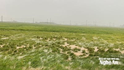
Currently, the water level on Thao River (Lao Cai), rivers in Ha Tinh , and northern Quang Tri is rising; water levels on other rivers are fluctuating.
Water level at 1:00 p.m. on August 25 on Gianh River ( Quang Tri ) at Dong Tam station was 7.74m, 0.74m above alert level 1; other rivers are still below alert level 1.
.jpg)
Warning: From today (August 25) to August 28, on Thao River ( Lao Cai ), rivers from Thanh Hoa to Quang Tri will experience 1 flood.
During this flood, the flood peak on small rivers, upstream of Ca River (Nghe An), Ngan Sau River, Ngan Pho River (Ha Tinh), Gianh River (Quang Tri) reached level 2-3, some places above level 3; Buoi River, upstream of Ma River (Thanh Hoa), Kien Giang River, Thach Han River (Quang Tri) reached level 1-2 and above level 2; Thao River, downstream of Ca River (Nghe An), La River (Ha Tinh) reached level 1 and above level 1.
There is a high risk of flooding in low-lying areas along rivers, urban areas, densely populated areas, flash floods and landslides on steep slopes in mountainous areas of Lao Cai, Phu Tho provinces and provinces from Thanh Hoa to Quang Tri (Real-time warning information on areas at risk of flash floods and landslides is provided online on the website of the Department of Hydrometeorology at:
https://luquetsatlo.nchmf.gov.vn and in separate bulletins warning of flash floods and landslides).
Risk of insecurity at important small hydroelectric and irrigation reservoirs.
Flood disaster risk warning level: Level 2
Flood impact warning: Floods on rivers and streams can cause flooding in low-lying areas along rivers, affecting activities such as water transport, aquaculture, agricultural production, people's lives and socio-economic activities.
Source: https://baonghean.vn/canh-bao-lu-dang-len-tren-cac-song-10305197.html


![[Photo] General Secretary To Lam attends the 80th anniversary of Vietnam's diplomacy](https://vphoto.vietnam.vn/thumb/1200x675/vietnam/resource/IMAGE/2025/8/25/3dc715efdbf74937b6fe8072bac5cb30)


Comment (0)