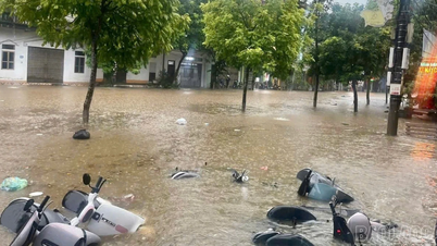
Da Lat city (Lam Dong province) is located at an altitude of about 1,500 meters above sea level, but recently, localized flooding has occurred in some areas along the streams, which are the only drainage of Da Lat. The streams are being significantly narrowed by construction activities along both sides, which is one of the causes of flooding here.
Báo Sài Gòn Giải phóng•11/09/2025
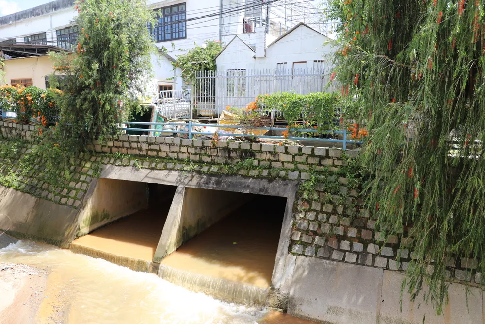
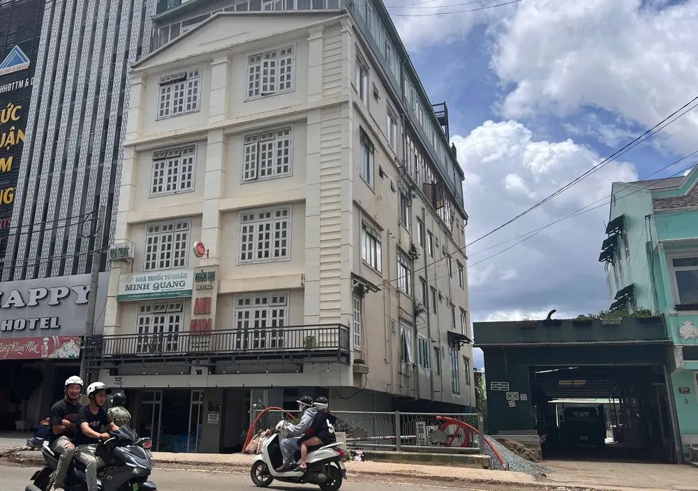
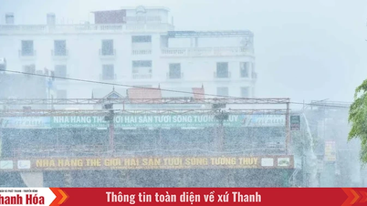
Video of narrowed streams in Da Lat. By: DOAN KIEN The stream crossing Phan Dinh Phung Street, Xuan Huong Ward - Da Lat. This is a "hot spot" that is often flooded during heavy rains. The small exit, along with the pipe system below, "accidentally" becomes an obstacle when flood water and garbage from upstream flow down. The water could not escape through the sewer in time and overflowed onto the road. Phan Dinh Phung Street is flooded more often during heavy rains. Right in this area, a restaurant used the stream surface to build a structure above. The construction exists right on the stream surface but has existed for a long time without being completely handled. Not far away, the bridge connecting the two sides of To Ngoc Van street continues to become a bottleneck. The stream is inherently narrow, but the design with an additional pillar in the middle of the stream also helps to block water when it encounters waste and household items flowing from upstream. Next to that, people drying items had water flooding into their houses after the rain on the afternoon of September 10. Another "black spot" for flooding is the Hai Thuong bridge, the low designed bridge surface prevents water from draining quickly. Hai Thuong Street was deeply flooded in the afternoon rain on September 10. On Nguyen An Ninh Street, Cam Ly Ward - Da Lat, traces of flooding and mud are still intact. The entire residential area is large, but currently the drainage is a small, narrow stream, with only sewer pipes less than 1 meter in diameter. Construction project near the stream flowing through La Son Phu Tu street A section of the stream flowing from Ha Dong flower village through Xo Viet Nghe Tinh and Nguyen Cong Tru streets has been narrowed by construction works. Similarly, the stream crossing Hoang Van Thu Street is littered with garbage left behind after the heavy rain. Construction work encroaches on Cam Ly stream corridor flowing through Cam Ly ward - Da Lat In the stream area of Yersin planning area, Lam Vien ward - Da Lat, recently, investment has been made to build a retaining wall. However, many constructions on the stream surface have gradually taken shape. Many times, local flooding has occurred here because the water cannot drain quickly enough. At the end of the stream section of the Yersin planning area, new constructions continue to form, turning the stream into a "sewer".


 Báo Sài Gòn Giải phóng•11/09/2025


![[Photo] Launching Ceremony of the Specialized Electronic Information Page of the Communist Party of Vietnam - 14th Congress](https://vphoto.vietnam.vn/thumb/1200x675/vietnam/resource/IMAGE/2025/9/12/4c1b894be2ea4e3daccfd8c038b6fb46)
![[Photo] Thac Ba Lake: Towards an international-class tourism, resort and cultural center by 2040](https://vphoto.vietnam.vn/thumb/1200x675/vietnam/resource/IMAGE/2025/9/12/0940443efe0a427b88707caadba1cc41)
![[Photo] General Secretary To Lam attends the launching ceremony of the website of the Communist Party of Vietnam - 14th National Congress](https://vphoto.vietnam.vn/thumb/1200x675/vietnam/resource/IMAGE/2025/9/12/0d4fce7dbce2409cb3c03c21fdf3c3b5)


![[Photo] Where the history of resistance comes alive with modern technology at "95 years of the Party Flag lighting the way"](https://vphoto.vietnam.vn/thumb/1200x675/vietnam/resource/IMAGE/2025/9/12/81c1276f52b849c8b16e2d01dd1c85e4)


Comment (0)