
According to the National Center for Hydro-Meteorological Forecasting, this morning (June 11), the tropical depression in the eastern area of Hoang Sa archipelago has strengthened into a storm and become the number 1 storm of 2025, with the international name WUTIP.
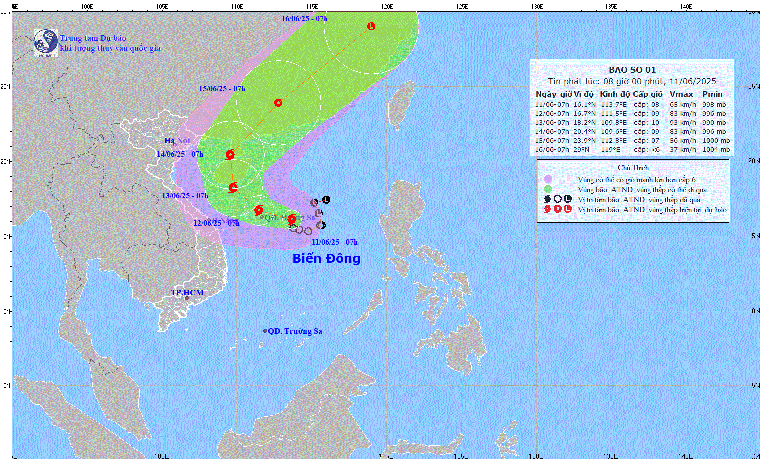
The storm's eye is currently at 16.1 degrees North latitude; 113.7 degrees East longitude, in the sea east of the Hoang Sa archipelago. With a level 8 intensity (62-74km/h), gusts of level 10.
Currently, storm No. 1 is moving slowly in the West Northwest direction, at a speed of 5-10km/h.
Storm forecast for the next 24-72 hours:
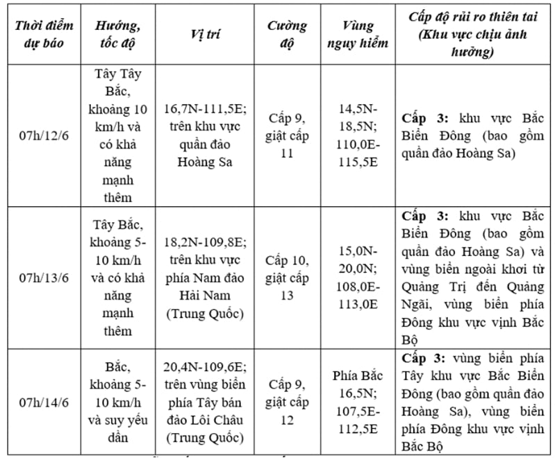
Forecast from the next 72 to 120 hours, the storm will move in the North Northeast direction, then change to the Northeast direction, speed 20km/h.
Under the impact of the storm, at sea, the North East Sea (including the waters of Hoang Sa archipelago), the North of the Central East Sea area has thunderstorms and strong winds of level 6-7, then increasing to level 8-9, gusting to level 11, waves 2.5-4.5m high, very rough seas.
In the South of the Central East Sea and South East Sea (including the waters of Truong Sa archipelago), there is strong southwest wind at level 6, sometimes level 7, gusting to level 8-9, waves 2.0-4.0m high, rough seas.
Ships at sea should pay attention to thunderstorms, tornadoes, strong winds and large waves.
Source: https://baohungyen.vn/ap-thap-nhiet-doi-da-manh-len-thanh-bao-dang-o-tren-quan-dao-hoang-sa-3181720.html


Comment (0)