

Response image of Phu Lien Weather Radar at 1:30 p.m. on July 19, 2025 (excerpt from the warning bulletin of thunderstorms, tornadoes, lightning, hail and local heavy rain in Quang Ninh province issued at 1:30 p.m. on July 19)
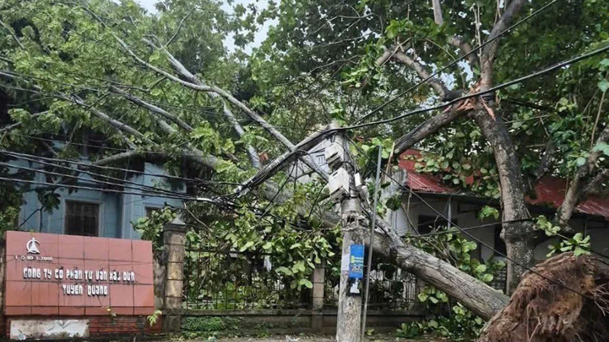
On the afternoon of July 19, there were widespread thunderstorms in the Northern region, with many places experiencing strong thunderstorms, tornadoes and strong gusts of wind, with some places experiencing heavy to very heavy rain. Some places with strong gusts of wind include: Cua Ong station (Quang Ninh) 16m/s (level 7), Bai Chay station (Quang Ninh) 26m/s (level 10), Bach Long Vi station (Hai Phong) gusting 18m/s (level 8);...
According to the National Center for Hydro-Meteorological Forecasting, the thunderstorm phenomenon is not due to the influence of storm No. 3's circulation. On the afternoon of July 19, the center of storm No. 3 was at about 20.7 degrees North latitude; 118.4 degrees East longitude (over 1,000km east of Ha Long Bay), the storm's circulation was about 200-300km (from the storm's center). The strongest wind near the storm's center was level 10 (89-102km/h), gusting to level 12 and had not directly affected the Gulf of Tonkin.
The cause of the heavy thunderstorms this afternoon in the North and the Gulf of Tonkin is the influence of the tropical convergence zone with its axis passing through the North, combined with the high temperature conditions in the North in the past 3 days, causing strong updrafts in the unstable conditions of the atmosphere, causing heavy thunderstorms.
These are Mesoscale Convective Systems (MCSs in the tropics) which are medium-sized thunderstorms that often produce very heavy rain and other dangerous weather phenomena.
Supercell thunderstorm systems range in diameter from a few kilometers to several hundred kilometers. They consist of multiple clusters of thunderstorms that combine to form a large system. They can last for hours, even 12–24 hours, and are stronger and longer lasting than individual thunderstorms.
Regarding forecasting, in the marine weather forecast for the day and night of July 19 (issued at 4:30 a.m.), the National Center for Hydro-Meteorological Forecasting predicted that the Gulf of Tonkin will have scattered showers and thunderstorms during the day; scattered showers and thunderstorms at night. There is a possibility of tornadoes and strong gusts of wind during thunderstorms.
Quang Ninh Provincial Hydrometeorological Station has warned, issued and transmitted forecasts and warnings of thunderstorms, tornadoes, lightning, hail and local heavy rain to the designated addresses. Specifically:
Through monitoring weather radar images, when detecting developing convective clouds, the Station issued two bulletins at 11:45 and 13:30 on July 19. In particular, in the bulletin issued at 13:30, the Station warned of showers and thunderstorms for wards and communes in the province, including Ha Long ward.
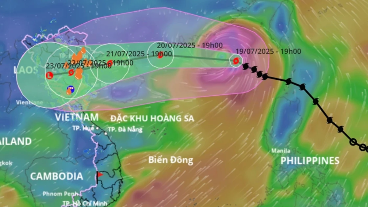
Regarding the hydrological weather situation in the coming time, due to the influence of Storm No. 3, from the night of July 19 and July 20, the Gulf of Tonkin, the North and Central East Sea (including the Hoang Sa special zone) will have showers and thunderstorms, especially the northern sea area of the North East Sea, and the Gulf of Thailand will have scattered showers and thunderstorms.
From the night of July 20 and July 21, the northern sea area of the North East Sea will have strong winds of level 8-9, near the storm's eye, winds of level 10-12, gusts of level 15; waves 4.0-6.0m high; rough seas.
From July 21, the sea area to the east of the Northern Gulf of Tonkin will have winds gradually increasing to level 6-7, then increasing to level 8-9, near the storm center level 10-11, gusting to level 13; waves from 2.0-4.0m high, near the center 3.0-5.0m; rough seas.
Thu Cuc
Source: https://baochinhphu.vn/ly-giai-nguyen-nhan-mua-dong-manh-tai-bac-bo-102250719225518511.htm


Comment (0)