
 |
| Location and forecast direction of the storm. |
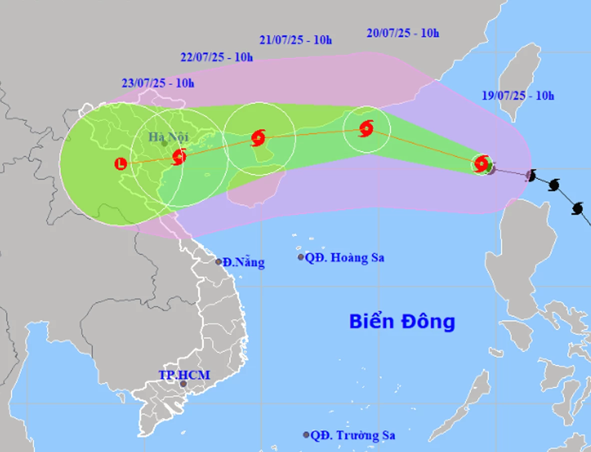
Storm No. 3 is forecast to continue moving west-northwest at a speed of 20-25 km/h and continue to strengthen. At 10:00 a.m. on July 20, the storm was located in the northern sea area of the North East Sea; about 450 km east of Leizhou Peninsula (China); the strongest wind near the storm center was level 11-12, gusting to level 15. By July 21, the storm was located on the mainland north of Leizhou Peninsula (China) with winds of level 10-11, gusting to level 13. After that, the storm mainly moved west, gradually weakened and was located in the coastal area of the North on July 22; winds of level 8-9, gusting to level 11.
 |
| Strong winds, large waves and thunderstorms are forecast at sea. |
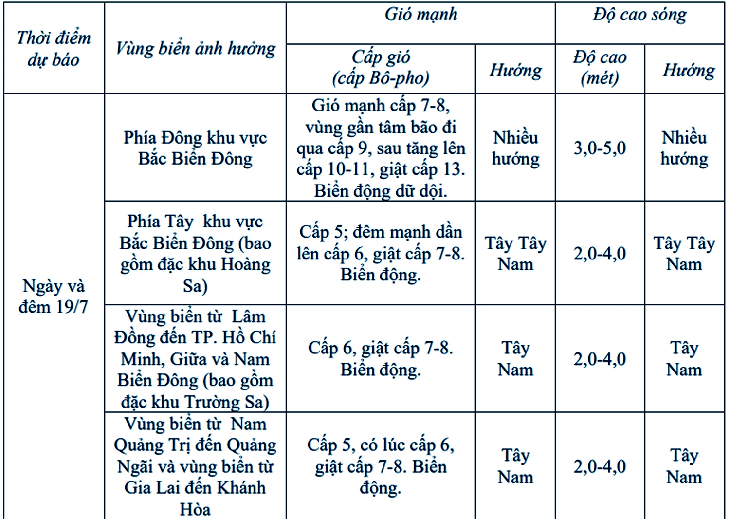
Due to the impact of the storm, on July 19, the northeastern sea area of the northern East Sea had strong winds of level 8-9, later increasing to level 10. The area near the center of the storm had strong winds of level 11-12, gusting to level 15; waves 4-6m high; rough seas. Ships operating in the dangerous area are at high risk of encountering thunderstorms, tornadoes, strong winds and large waves; therefore, it is necessary to closely monitor the storm situation and take measures to ensure the safety of people and vehicles operating at sea.
H.D
Source: https://baokhanhhoa.vn/xa-hoi/202507/con-bao-so-3-giat-cap-11-di-chuyen-nhanh-61f6abb/


Comment (0)