

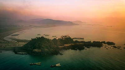
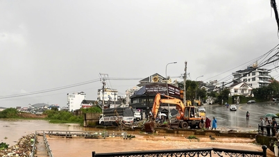
Illustration photo: National Center for Hydro-Meteorological Forecasting

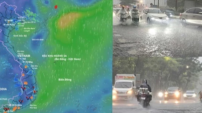
The northwestern sea area of the northern East Sea has storms and rain, the Gulf of Thailand has scattered showers and thunderstorms.
Forecast for the next 24 hours in the northwest sea area of the northern East Sea is level 6-8, near the storm center is level 9-10, gusting to level 12. The sea is very rough. At night the wind will gradually decrease, waves are 4m-6m high.
In addition, on the day and night of September 8, the northern East Sea (including Hoang Sa special zone), the central and southern East Sea (including Truong Sa special zone), the Gulf of Tonkin, the sea area from Lam Dong to Ca Mau, Ca Mau to An Giang , and the Gulf of Thailand will have scattered showers and thunderstorms; especially the northwest sea area of the northern East Sea will have storms during the day.
During thunderstorms, there is a possibility of tornadoes, strong gusts of wind level 6-7 and waves higher than 2m.
Wind warning in the northwest sea area of the northern East Sea continues to decrease.
The level of disaster risk due to strong winds at sea in the northwest sea area of the northern East Sea is level 3.
It is forecasted that ships operating in the above areas are at high risk of being affected by cyclones at sea, strong winds, large waves, and rough seas./.
According to Nhan Dan Newspaper
Source: https://nhandan.vn/canh-bao-gio-manh-song-lon-va-mua-dong-tren-bien-do-tac-dong-cua-bao-so-7-post906637.html
Source: https://baolongan.vn/canh-bao-gio-manh-song-lon-va-mua-dong-tren-bien-do-tac-dong-cua-bao-so-7-a202135.html


![[Photo] Experience at the Exhibition of 80 years of national achievements - Meaningful activity for new students](https://vphoto.vietnam.vn/thumb/1200x675/vietnam/resource/IMAGE/2025/9/10/286061b79abb4afa8961d730c9833cdd)
![[Photo] Close-up of 3,790 resettlement apartments in Thu Thiem to continue auction](https://vphoto.vietnam.vn/thumb/1200x675/vietnam/resource/IMAGE/2025/9/10/be974e2058f74c9c8dc1f400124f3653)
![[Photo] Giant pipeline leading water to West Lake, contributing to reviving To Lich River](https://vphoto.vietnam.vn/thumb/1200x675/vietnam/resource/IMAGE/2025/9/10/887e1aab2cc643a0b2ef2ffac7cb00b4)


Comment (0)