
According to the National Center for Hydro-Meteorological Forecasting, at 7:00 p.m. on July 20, the storm's center was located in the northwest sea of the North East Sea, about 480 km east of Quang Ninh - Hai Phong . The strongest wind speed reached 117 km/h, equivalent to level 11, gusting to level 14. The storm moved west at a speed of 20 km/h.
It is forecasted that by 7pm on July 21, the storm will be in the northern part of the Gulf of Tonkin, with the strongest winds reaching level 11-12, gusting to level 15, and moving west-southwest at a speed of 20-25 km/h. By 7pm on July 22, the storm will be level 9-10, gusting to level 12, on the mainland along the coast of Hai Phong - Thanh Hoa , then making landfall and weakening into a tropical depression.
The Japan Meteorological Agency and Hong Kong Radio both predict that the storm will pass north of the Leizhou Peninsula and enter the Gulf of Tonkin without weakening, maintaining winds of about 108 km/h. The storm's eye is expected to make landfall in the provinces from Quang Ninh to Ninh Binh .
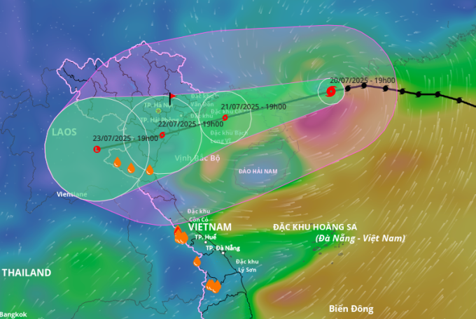
Forecast of the direction and affected area of typhoon Wipha. Photo: Disaster monitoring system
Due to the storm, the northwestern part of the East Sea has strong winds of level 8-9, near the storm center level 10-11, gusts of level 14; waves 5-7 m high. The northern part of the Gulf of Tonkin (including Bach Long Vi, Co To, Cat Hai, Hon Dau) has winds gradually increasing to level 6-7, then reaching level 10-12, gusts of level 15; waves 3-5 m high. The southern part of the Gulf of Tonkin (including Hon Ngu island) also has strong winds of level 8-9, gusts of level 11; waves 2-4 m high.
The Center for Hydro-Meteorological Forecasting warns that weather and oceanographic conditions are extremely dangerous and unsafe for all means of transport operating at sea, including cruise ships, passenger ships and transport ships.
From the evening and night of July 21, coastal areas from Quang Ninh to Nghe An will begin to experience strong winds of level 7-9, near the storm center of level 10-11, gusting to level 14. Inland areas will experience winds of level 6-7, gusting to level 8-9. Winds of level 10-11 can knock down trees, electric poles, and roofs, causing great damage.
From July 21 to 23, the North, Thanh Hoa and Nghe An will have widespread rain of 200-350 mm, some places over 600 mm; other areas of the North and Ha Tinh will have rain of 100-200 mm, some places over 300 mm. There is a risk of extreme rain of over 150 mm in three hours, causing flash floods, landslides in mountainous areas and flooding in low-lying areas.

Navy Region 1 soldiers reinforce the roof. Photo: Navy
At an online meeting with 1,700 communes and wards on the morning of July 20, Deputy Prime Minister Tran Hong Ha requested specialized agencies to closely update the situation and accurately assess the scale and level of impact of the storm. He noted that localities must review the response capacity of their apparatus after the merger, ensuring unified direction and effective coordination among forces.
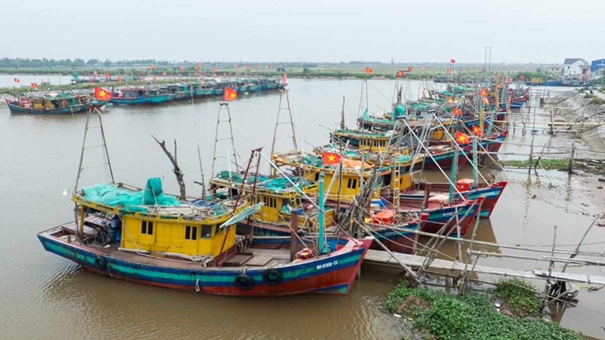
In response to Typhoon Wipha, Quang Ninh Province has banned all tourist boats from operating in Ha Long Bay since today, and has also stopped all passenger boats to and from the islands. The boats are allowed to return to the mainland to drop off passengers but are not allowed to leave the port afterwards.
Ninh Binh province will ban the sea from 7am on July 21, and organize evacuation of people in vulnerable dyke areas before noon. Hung Yen will ban the sea from 6pm on July 20. Hai Phong will also start banning the sea from 5pm today.
Source vnexpress.net
Source: https://baophutho.vn/bao-wipha-manh-cap-11-tien-vao-vinh-bac-bo-236434.htm


![[Photo] National Assembly Chairman Tran Thanh Man visits Vietnamese Heroic Mother Ta Thi Tran](https://vphoto.vietnam.vn/thumb/1200x675/vietnam/resource/IMAGE/2025/7/20/765c0bd057dd44ad83ab89fe0255b783)


Comment (0)