
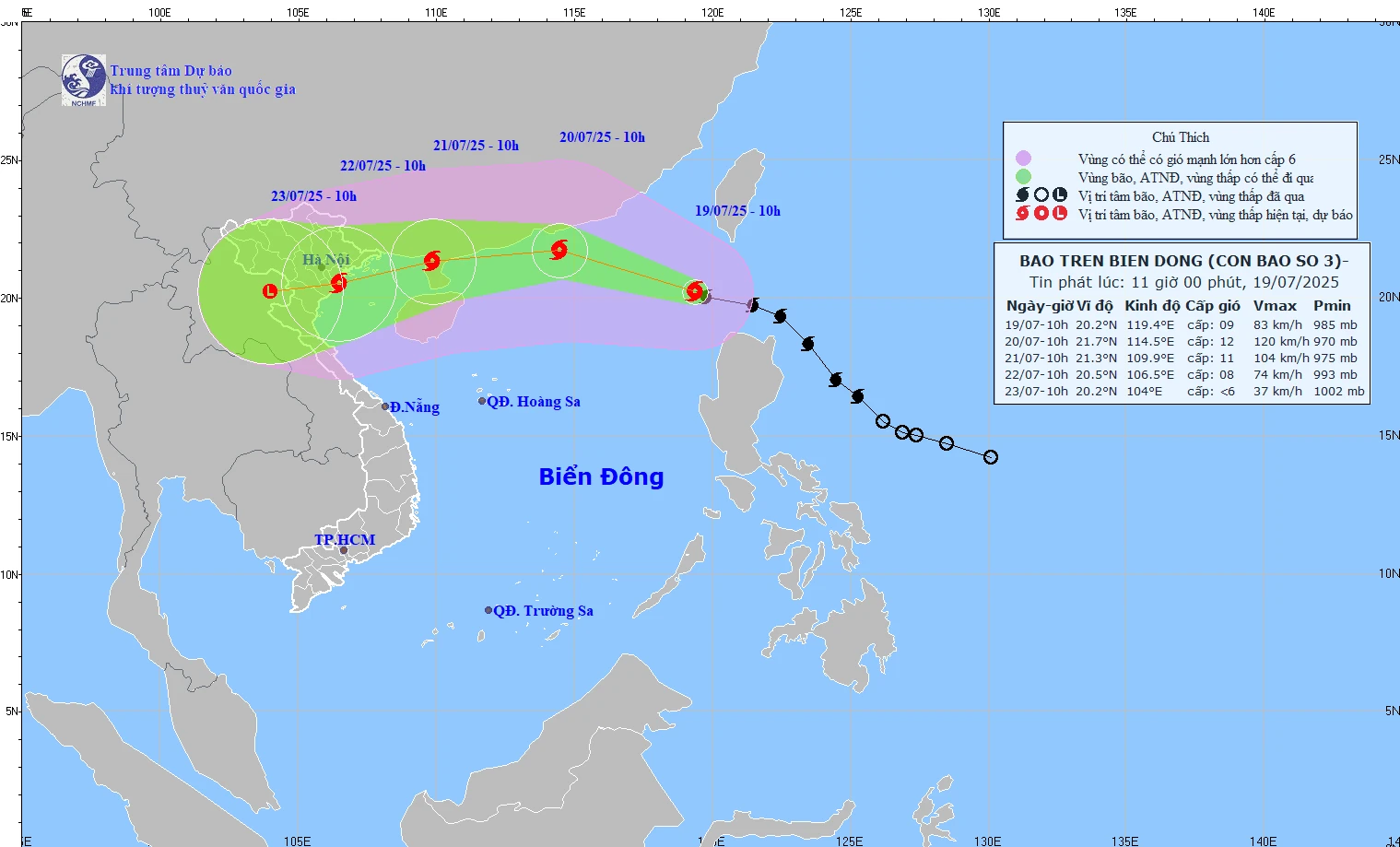
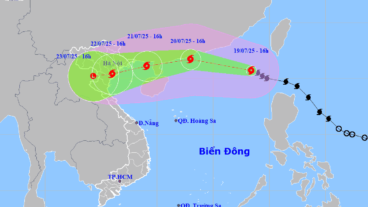
Forecast of storm path at 11:00 on July 19, 2025.
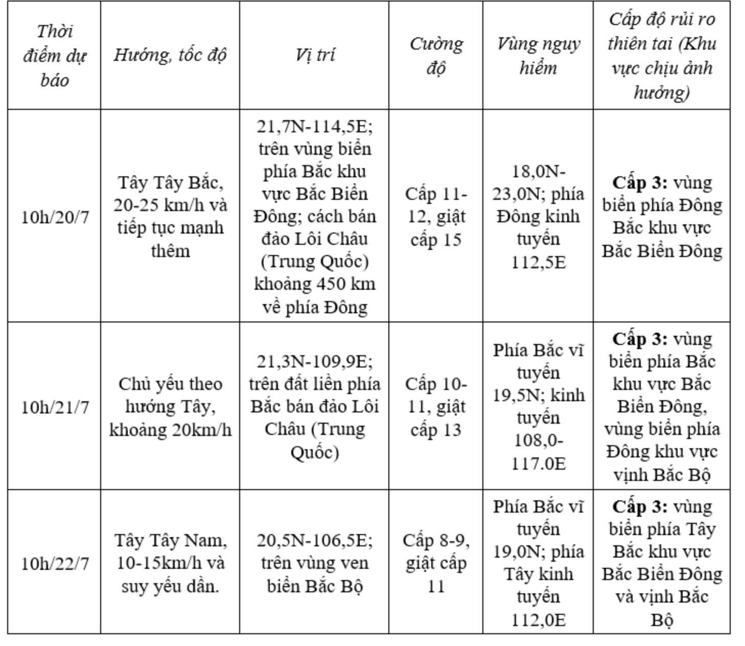
Forecast, at 10am on July 20, the storm will move in the West Northwest direction, increasing speed to 20-25km/h and continue to strengthen. The center of the storm is located at 21.7 degrees North latitude, 114.5 degrees East longitude; in the northern sea area of the North East Sea; about 450km east of Leizhou Peninsula (China). Intensity level 11-12, gust level 15.
At 10:00 a.m. on July 21, the storm moved mainly to the West, at a speed of about 20 km/h; located at 21.3 degrees North latitude, 109.9 degrees East longitude; on the mainland north of Leizhou Peninsula (China). Intensity level 10-11, gust level 13.
At 10:00 a.m. on July 22, the storm moved in a West Southwest direction at a speed of 10-15 km/h and gradually weakened.
Storm forecast (in the next 24 to 72 hours).
From the next 72 to 96 hours, the storm will move mainly in the West Southwest direction, about 10km per hour and continue to weaken.
Due to the impact of the storm, the northeastern sea area of the North East Sea has strong winds of level 8-9, then increasing to level 10. The area near the storm's center: strong winds of level 11-12, gusting to level 15. Waves are 4-6m high. The sea is very rough.
Vessels operating in the danger zone are at high risk of encountering thunderstorms, tornadoes, strong winds and large waves.
NDS
Source: https://baothanhhoa.vn/bao-wipha-dang-di-chuyen-voi-toc-do-20km-h-va-tiep-tuc-manh-them-255287.htm


Comment (0)