
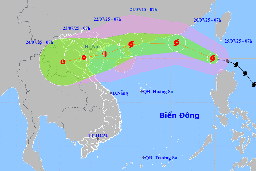
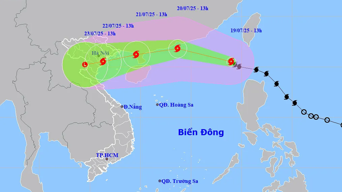
Forecast at 7:00 a.m. on July 20, the center of the storm is at about 21.8 degrees north latitude, 115.7 degrees east longitude, in the northern area of the North East Sea, about 600km east of Leizhou Peninsula (China) with the strongest wind at level 10-11, gusting to level 13.
After moving through the Leizhou Peninsula (China), at 7:00 a.m. on July 22, the center of storm No. 3 was at about 20.5 degrees north latitude, 107.5 degrees east longitude, in the Gulf of Tonkin with the strongest wind at level 9, gusting to level 12.
The sea area affected by storm No. 3 has strong winds of level 6-7, near the storm center level 8-9, later increasing to 10-11, gusting to level 13; waves 4-6m high, rough seas. Ships in the danger zone are at high risk of encountering thunderstorms, whirlwinds, strong winds and big waves.
To proactively respond to storms, especially for ships operating at sea, the Steering Committee for Natural Disaster Prevention, Search and Rescue and Civil Defense of Da Nang City has issued a telegram requesting the City Military Command to direct the Border Guard Command to promptly notify owners of vehicles and ships still operating at sea of storm information so that they can proactively avoid, escape or not move into dangerous areas; proactively manage ships going out to sea; organize ship counting...
Da Nang Coastal Information Station, coastal localities and relevant units promptly notify owners of vehicles and boats still operating at sea of storm information to proactively prevent it.
Departments, branches, localities and units closely monitor the storm's developments to proactively handle possible situations.
Source: https://baodanang.vn/bao-so-3-tang-toc-da-nang-ban-hanh-cong-dien-ung-pho-gio-manh-tren-bien-3297249.html


Comment (0)