
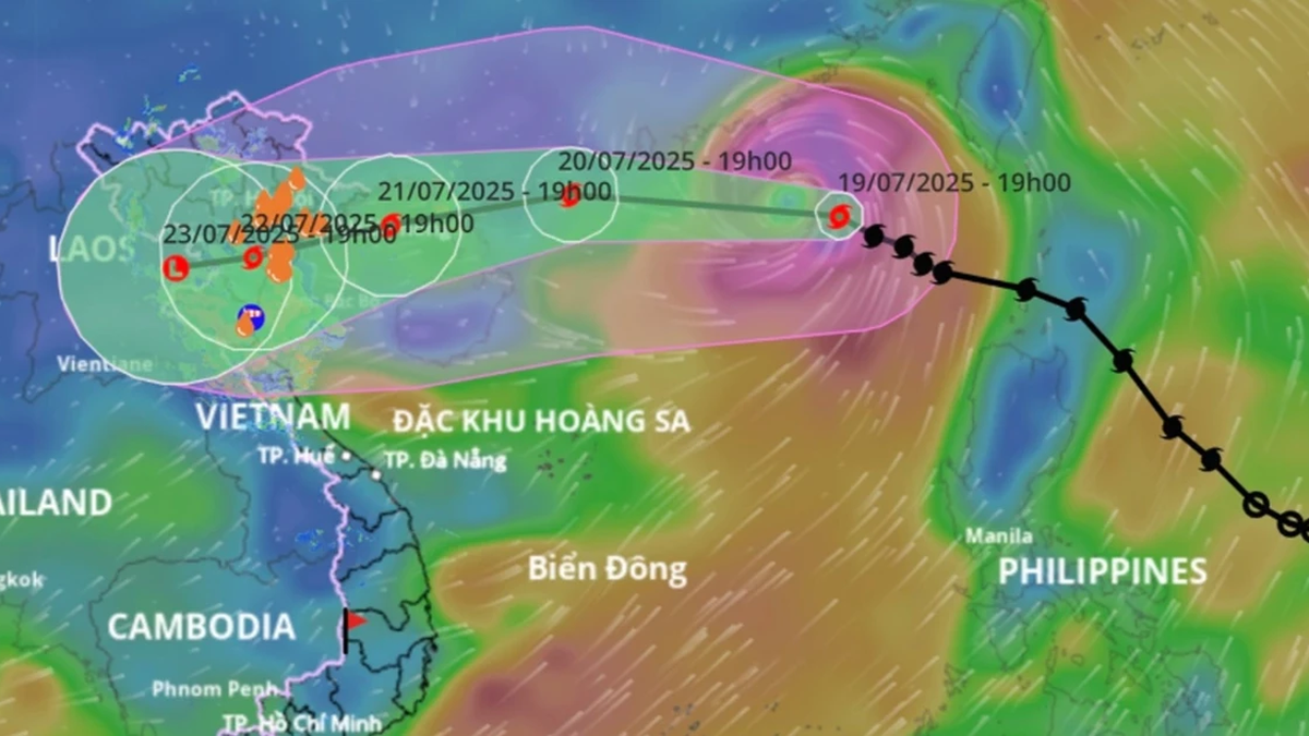
According to the National Center for Hydro-Meteorological Forecasting, at 7 p.m., the eye of the storm was located at about 21.1 degrees north latitude; 117.7 degrees east longitude, in the northeastern sea area of the northern East Sea. The strongest wind near the eye of the storm was level 10-11 (89-117 km/h), gusting to level 14; moving west-northwest at a speed of about 20-25 km/h, about 220 km east of Leizhou Peninsula (China).
By the evening of July 21, the storm may reach level 10-11, gusting to level 13 in the northern waters of the Gulf of Tonkin and turn west-southwest, at a speed of 15 km/h. Then, at around 7:00 p.m. on July 22, storm No. 3 will make landfall in the Northern Delta and Thanh Hoa with an intensity of about level 8, gusting to level 10. After that, the storm will move mainly in a west-southwest direction, traveling 5-10 km/h and continue to weaken.
Due to the influence of the storm, the northern sea area of the North East Sea has strong winds of level 8-10, the area near the storm's eye has winds of level 11-12, gusting to level 15; waves are 5-7m high. The sea is very rough.
From July 21, the northern sea area of Bac Bo Gulf (including the special zones of Bach Long Vi, Co To, Cat Hai, Cat Ba) will have winds gradually increasing to level 6-7, then increasing to level 8-9, the area near the storm's center will have winds of level 10-11, gusting to level 14; waves 2-4m high, near the center 3-5m. The sea will be very rough.
From the afternoon of July 21, the sea in the southern Gulf of Tonkin will have winds gradually increasing to level 6-7, near the storm center level 8-9, gusting to level 11, waves 2-4m high. The sea is very rough.
Ships operating in the above-mentioned dangerous areas are susceptible to storms, whirlwinds, strong winds, and large waves, so special attention must be paid to safety.
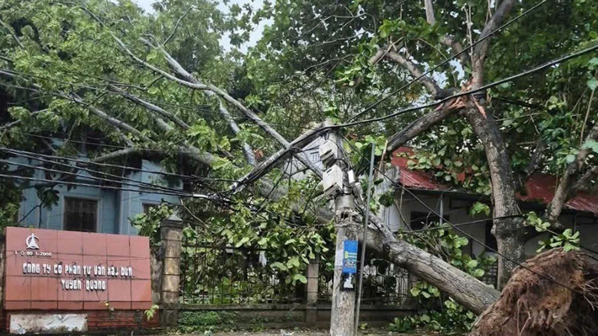
At the regular meeting of the National Steering Committee for Natural Disaster Prevention and Control on July 19, leaders of the Ministry of Agriculture and Environment assessed that storm No. 3 has a similar trajectory to the previous storm Yagi, and may not be as strong but has the risk of causing widespread heavy rain in the North.
In an urgent dispatch on responding to storm No. 3, the Ministry of Agriculture and Environment recommends:
For mountainous areas (including Lao Cai province - reporter), it is necessary to deploy shock forces to inspect and review residential areas along rivers, streams, low-lying areas, areas at risk of flooding, flash floods, landslides to proactively clear the flow of blocked and obstructed areas; organize the relocation and evacuation of people to safe places; direct commune-level authorities to notify each household living in areas at risk of landslides and flash floods to inspect and review the area around their residence to promptly detect unusual and dangerous signs to proactively evacuate from dangerous areas;
Prepare plans to organize forces to guard, control, support, and guide to ensure safe traffic for people and vehicles, especially at culverts, spillways, deep flooded areas, areas with strong currents, areas where landslides have occurred or are at risk of landslides; resolutely not allow people and vehicles to pass if safety is not ensured; arrange forces, materials, and means to overcome incidents, ensuring smooth traffic on main traffic routes when landslides occur;
Direct the inspection, review, and preparation of plans to ensure the safety of mines, mines, reservoirs, and downstream areas, especially small hydroelectric reservoirs, small irrigation reservoirs, and critical reservoirs; arrange a permanent force to operate and regulate and be ready to handle possible situations.
Regularly monitor information from central and local media agencies on developments of storms and floods to proactively prevent and respond.
Source: https://baolaocai.vn/bao-so-3-dang-manh-len-cap-10-11-giat-cap-14-tren-bien-dong-post649236.html


Comment (0)