
On the morning of July 19, the Department of Hydrometeorology ( Ministry of Agriculture and Environment ) held a meeting on the developments and impacts of storm No. 3 and the flood situation caused by the storm.
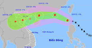 |
Forecast path of storm number 3. |
Accordingly, Typhoon Wipha formed in the sea east of the Philippines, with a strength of level 9. On the morning of July 19, the storm crossed the 120th meridian and entered the East Sea (the 6th storm in the Northwest Pacific region and the 3rd storm in the East Sea). The storm is currently at level 9, up 1 level in the past 24 hours, about 1,000km east of Leizhou Peninsula (China).
"This is a strong storm, moving quickly, with circulation shifting to the South and West. International storm forecasting centers have a unified assessment of the trajectory, but the intensity is different. Accordingly, storm No. 3 has the strongest intensity that can reach level 12-13, gusting to level 14-15 when in the eastern area of Leizhou Peninsula (China), moving over mainland China, weakening rapidly; entering the Gulf of Tonkin, the intensity is about level 8-10", the meteorological agency said.
The meteorological agency said that the biggest and most dangerous risk in the next 24 hours is strong winds and big waves in the northern and central areas of the East Sea (Hoang Sa special zone); the northern sea area of the North East Sea where the storm passes through has wind intensity of level 10-12, gusts of level 15, waves 3-5m high, and 4-6m high near the storm's center.
From around July 20 to 21, the special zones of Bach Long Vi, Co To, Cat Hai... are likely to be heavily affected by strong winds and heavy rains caused by storm No. 3. Around early morning and on July 22, coastal areas from Quang Ninh to Thanh Hoa will begin to be directly affected by strong winds, heavy rains and rising waters with strong winds of level 7-9, waves of 3-5m high. Large waves combined with high tides can cause flooding in low-lying areas along the coast of Quang Ninh - Hai Phong (from noon and afternoon on July 21-23).
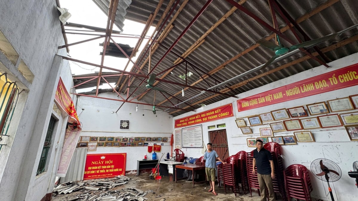
On land, the scope of influence of storm No. 3 is wide, almost the entire Northeast region, some places in the Northwest, North Central provinces: Directly affected include Quang Ninh, Hai Phong provinces, coastal provinces of Hung Yen, Ninh Binh, Thanh Hoa are forecasted to be most strongly affected by the storm.
Storm No. 3 is forecast to cause widespread heavy rain in the North and Thanh Hoa - Ha Tinh provinces; in which, in the midlands and the Northern Delta, Thanh Hoa, Nghe An, the rainy period from July 21-24, some places will have localized heavy rain with rainfall over 150mm/3 hours;
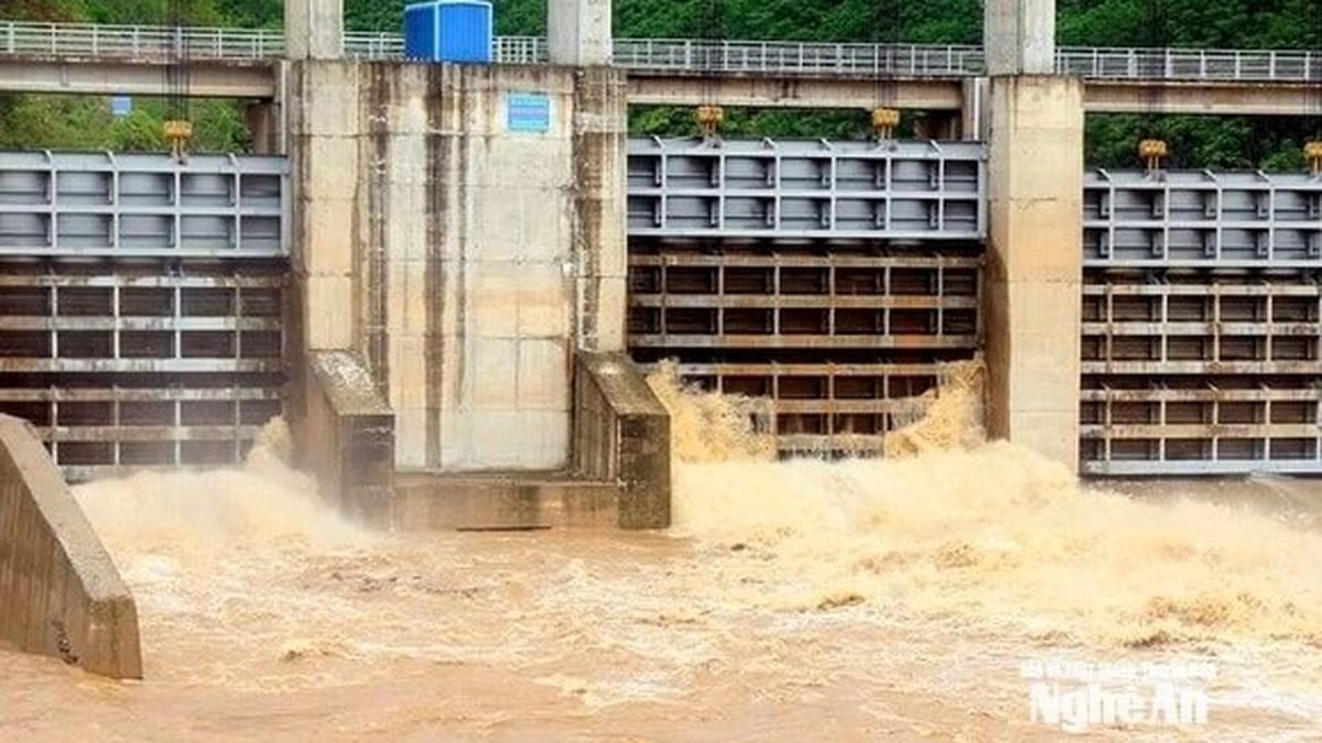
From July 21 to 24, there is a possibility of a flood on rivers in the North, Thanh Hoa, and Nghe An, with a flood amplitude of 3-6m. There is a high risk of flooding in low-lying areas along rivers, urban areas, and densely populated areas. Flash floods and landslides on steep slopes in mountainous areas of the North, Thanh Hoa, and Nghe An.
Thunderstorms will occur early from July 20 to 21
Dr. Hoang Phuc Lam, Deputy Director of the National Center for Hydro-Meteorological Forecasting, said that currently, storm No. 3 has a level 9 intensity, which is about 1 level stronger than 24 hours ago. In the next 24 hours, the storm will continue to move rapidly in the West-Northwest direction, at a speed of about 20 km/h and is likely to strengthen further, forecast to reach a peak intensity of level 12 when approaching the mainland of southern China.
Storm No. 3 has a notable characteristic of moving quickly and the distribution of rain and strong winds to the west and south. Therefore, although the center of the storm is still offshore, thunderstorms caused by the circulation ahead of the storm may occur early from July 20 to 21, affecting the Gulf of Tonkin and the sea area east of the Leizhou Peninsula.
According to Dr. Hoang Phuc Lam, with the current direction, storm No. 3 will directly affect the mainland of our country from around the morning of July 22, first of all the northern coastal provinces.
The Gulf of Tonkin is likely to experience strong winds of level 9-10, gusting to level 12 as the storm approaches the Leizhou peninsula.
On land, the storm circulation will cause very heavy rain over a wide area in the Northern region and the North Central provinces.
Total rainfall within 3 hours in some places can reach 150mm, causing high risk of flash floods and landslides in mountainous provinces, especially the Northwest, Northeast, Thanh Hoa and Nghe An regions.
The meteorological agency advised people in the Northern and North Central provinces to closely monitor weather forecasts in the coming days and proactively respond to heavy rain, strong winds and dangerous weather phenomena caused by storms.
TS (synthesis)
Source: https://baobacninhtv.vn/5-tinh-thanh-pho-du-bao-chiu-tac-dong-manh-boi-bao-so-3-postid422216.bbg


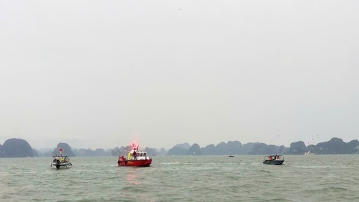
![[Infographic] Information on the capsized tourist boat carrying 48 passengers and 5 crew members in Ha Long Bay](https://vphoto.vietnam.vn/thumb/1200x675/vietnam/resource/IMAGE/2025/7/19/675795afcd3e4a179b25edc2d7a57f9e)


Comment (0)